It’s Old West and New Northwest, ocean and mountains, rivers and forests, wineries and ranches, artisan foods and outdoor sports. As the travel pros of the Beaver State like to say, there isn’t a single amazing thing about Oregon — there are about 10 zillion.
It’s a humble little sign.
Sticking out of the sidewalk at the end of a short street that dead-ends right at the coast in the small town of Cannon Beach, it’s easy to overlook. The story it tells, however, is anything but modest: the legend of the Oregon Beach Bill.
Passed in 1967, HB 1601 is a landmark piece of legislation guaranteeing free and open public access to all 363 miles of Oregon’s undeveloped coastline.
“Of all the U.S. coastal states, the state of Oregon may have the best legal protection for the public’s use of and access to its coastal land,” the Surfrider Foundation has proclaimed. Only Texas and Hawaii have public beach access laws that compare to Oregon’s.
The Beach Bill was no sure thing. Debate over commercial development of the shoreline consumed Oregonians. It’s still regarded as the largest legislative issue in the state’s history.
The effort to get it passed brought together an unlikely coalition of environmental activists, conservative Republicans, and a governor committed to “raising hell” (as one fellow pol of the day said) to protect shores to an unprecedented 16 feet above sea level. During the political to-and-fro, publicity-savvy Gov. Tom McCall made a showboating appearance at the coast, arriving by helicopter to personally assist in the effort to survey boundaries for the new law.
Public ownership of beaches, he said, is something “we cannot live without as Oregonians.”
I’ve been in awe of these beaches since first tumbling down the velvety slopes of the Oregon Dunes National Recreation Area in the 1980s. Stretching for nearly 40 miles along the central coast, it’s the largest dunescape in the country. It’s easy here to sink into the sand halfway up your calves.
About three-fourths of Oregon’s coastline is wide and flat and filled with the kind of fine sand you normally find in an hourglass. Remaining sections are a mixture of theatrical cliffs, headlands, and gravel. One of the best places to snap an “Oh, wow!” panoramic photo is from Ecola Point, just north of that sign in Cannon Beach.
I’ve long maintained that if you could actually swim in the Pacific here — the water temperature is fit mostly for sea lions, migrating whales, and unusually plucky surfers — Oregon’s beaches would be the most crowded in the world.
Thankfully, they’re not. This is also because the entire state is a lot like that little Beach Bill sign. Out of the way, dangling on the edge of the continent, it gets comparatively little attention. Unassuming as it may be, however, it speaks to a grander idea of an indomitable human connection to a landscape like no other.
Timber Time
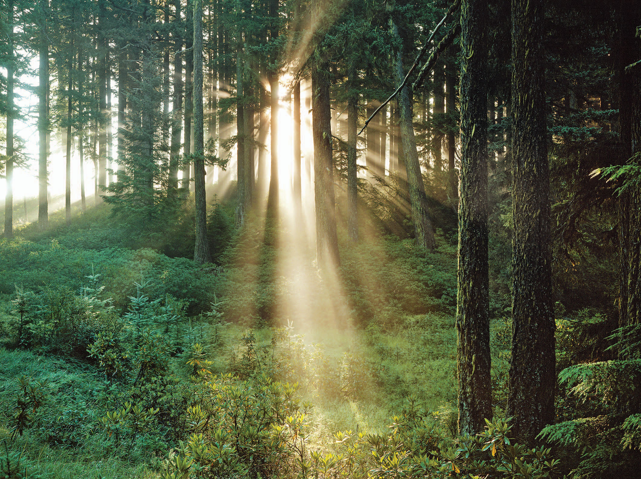
Oregonians are justly proud of their record of conservation, and not just for beaches. Plenty of everyday types wear the “tree hugger” slur like a badge of honor.
But the state is equally defined by the other side of that equation.
Almost 50 percent of Oregon is still covered by forest. Logging remains an important part of the economy and culture. At last check, Oregon owns 28 of the nation’s largest examples of various tree species. The biggest is the Doerner Fir, a 327-foot monster in Coos County. It’s the planet’s tallest non-redwood tree.
My favorite place to get a quick fix of the logging life — a place I’ve taken countless out-of-state visitors — is a roadside attraction called Camp 18.
Eighteen miles inland from the coast on Highway 26, Camp 18 is the brainchild of a local logger named Gordon Smith. Back in the 1970s, Smith, now 85, embarked on a mission to preserve the state’s timber heritage by collecting all manner of logging equipment. Today, his grounds are a veritable museum of artifacts — steam donkeys, railroad cars, every type of saw you can think of.
Although Camp 18’s giant cinnamon roll is enough to feed two starving loggers, the real reason to stop is the dauntless log cabin-style restaurant. The dining room is dominated by the biggest ceiling beam you’ll ever see: an 85-foot Douglas fir ridge pole that weighed about 25 tons when cut and has 5,600 board feet of lumber in it.
“Gordon brought it in on two trucks, one going forward, one going backward,” says wife Roberta, who with Gordon still runs the place on a daily basis. They were both born in the Coast Range and have stayed there for their entire lives.
All of the lumber used in the building was logged and milled by Smith himself. As far as I know, there’s no one-man operation in the country like it.
“He just wanted to build something out of logs and do something for the loggers,” Roberta says. “There were no plans to the building. It’s something he designed in his mind — there was nothing on paper. He just put the big log up in the middle and went from there.”
One Big City
Most visitors to Oregon will eventually pass through the city of Portland — since we’re on Highway 26, we might as well stop — if only because it’s hard to resist a town with its own off-kilter TV show.
The city of aggressively political bicyclists, where diners obsess over the provenance of their chicken entrees (his name was Colin) and young people go to retire — this is the gristle of Portlandia. Comedian John Hodgman has perfectly and hilariously described the scathing parody as “playing directly to Portlandians’ desire to be offended at all times ... but at the same time you’re also playing into their desire to be recognized and congratulated at all times.”
In fact, it’s a terrific city filled with hipster treasures from goat yoga (yoga, in a barn, with goats) to restaurants where the kale revolution is in full swing. But let’s face it, craft-beer-and-adult-kickball-league culture can be found in just about any American burg these days.
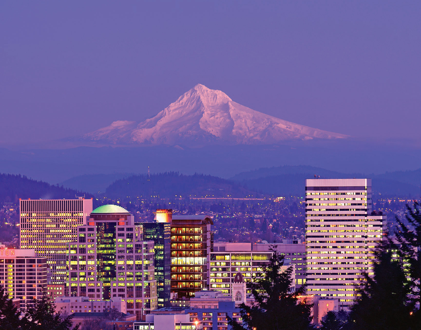
To longtime locals, what makes Portland exceptional is its proximity to nature. From the center of the tree-filled downtown it’s just 90 minutes west to the coast or east to the Cascade Range, which runs from Northern California to southern British Columbia and divides the state along an exceptionally scenic volcanic spine.
The focal point for Oregonians is Mount Hood. At 11,235 feet, it’s the highest peak in the state, easily visible on clear days from Portland and a year-round draw for hikers, paddlers, fishers, and skiers.
But the area I keep returning to is the Mount Jefferson Wilderness, south of Mount Hood. With 163 miles of forested trails, 150 lakes, five glaciers, rocky cliffs, and no end of hidden meadows, even on summer weekdays it’s not hard to find solitude.
Recently I had an intimate encounter with a majestic barred owl. It sat on a low cedar limb eyeing me mysteriously for a prolonged period before swiveling its head 180 degrees and flying off backward with a nearly silent flap of wings that had to have spanned 4 feet.
Portland attracts visitors with cultural eccentricities like Voodoo Doughnut — sugar, pink box, big deal. But it’s experiences like my owl communion that turn them into locals.
Same goes for the state’s 111,000 miles of rivers. For many, this is where the essence of Oregon is found.
My new favorite place to shout above the applause of rushing rapids is the Rogue-Umpqua Scenic Byway, a 172-mile stretch of road in southern Oregon. That I first made it to this wonder only last summer says less about my dogged pursuit of adventure and more about the many rivers to cross before one’s Oregon résumé is complete.
Oregon Route 138 between Glide and Diamond Lake is dubbed the Thundering Waters. The high-drama two-lane road hugs the Upper Rogue and North Umpqua rivers as it serpentines through emerald forest, 9,000-foot peaks, and hundreds of campsites.
There are 18 marked waterfalls along the way. Watson Falls is the highest. It drops 272 feet over the edge of a basalt lava flow and is reached by a trail less than half a mile long. Small effort, big payoff. You find that all over the state.
Ranchers, Gardeners, and Gurus
A confession: Here we are deep into a tour of Oregon, and we’ve barely covered a third of the state. My bias as a “flatlander” — as many people east of the Cascades call everyone west of them — is showing.
The Cascades don’t just divide the state topographically. They represent a cultural boundary as well. While two-thirds of the state lies east of the mountains, only about 17 percent of the population resides in central and eastern Oregon. And in proudly rural fashion. As one local posted on a message board in response to a prospective newcomer: “If you don’t garden out here, you would be [one] of the few [who] don’t.”
Cross the Cascades and you really do feel you’ve entered a different world. Dense woodlands give way to a sprawling, arid landscape dotted with farms, cattle ranches, and tiny towns spaced far apart. This is cowboy country, a lot of rangeland with few people, a place where outliers of all stripes have become part of Oregon lore.
In the early 1980s, cult leader Bhagwan Shree Rajneesh and 2,000 red-clad followers moved into a cattle ranch near Antelope (population 50) and attempted to create a desert utopia that came to include 93 Rolls-Royces for the Bhagwan. The group was eventually driven out of the state for legal issues.
The normally sedate Malheur National Wildlife Refuge gained notoriety last year as the site of a takeover by anti-government activists. The New York Times noted that the entire affair “had a Wild West quality, with armed men in cowboy hats taking on federal agents in a tussle over public lands.” It was a contentious issue, but no one could argue with that description.
But for the most part, a consistently congenial Western personality prevails across this part of Oregon. The state hosts a number of cowboy events — the spectacular Pendleton Round-Up (this year September 13 – 16) is the most well-known.
I’m also partial to the annual late-spring Spray Rodeo, which claims, rightly in my mind, to be the best little rodeo in the country. Tickets are a mere $10 and worth it for the setting alone.
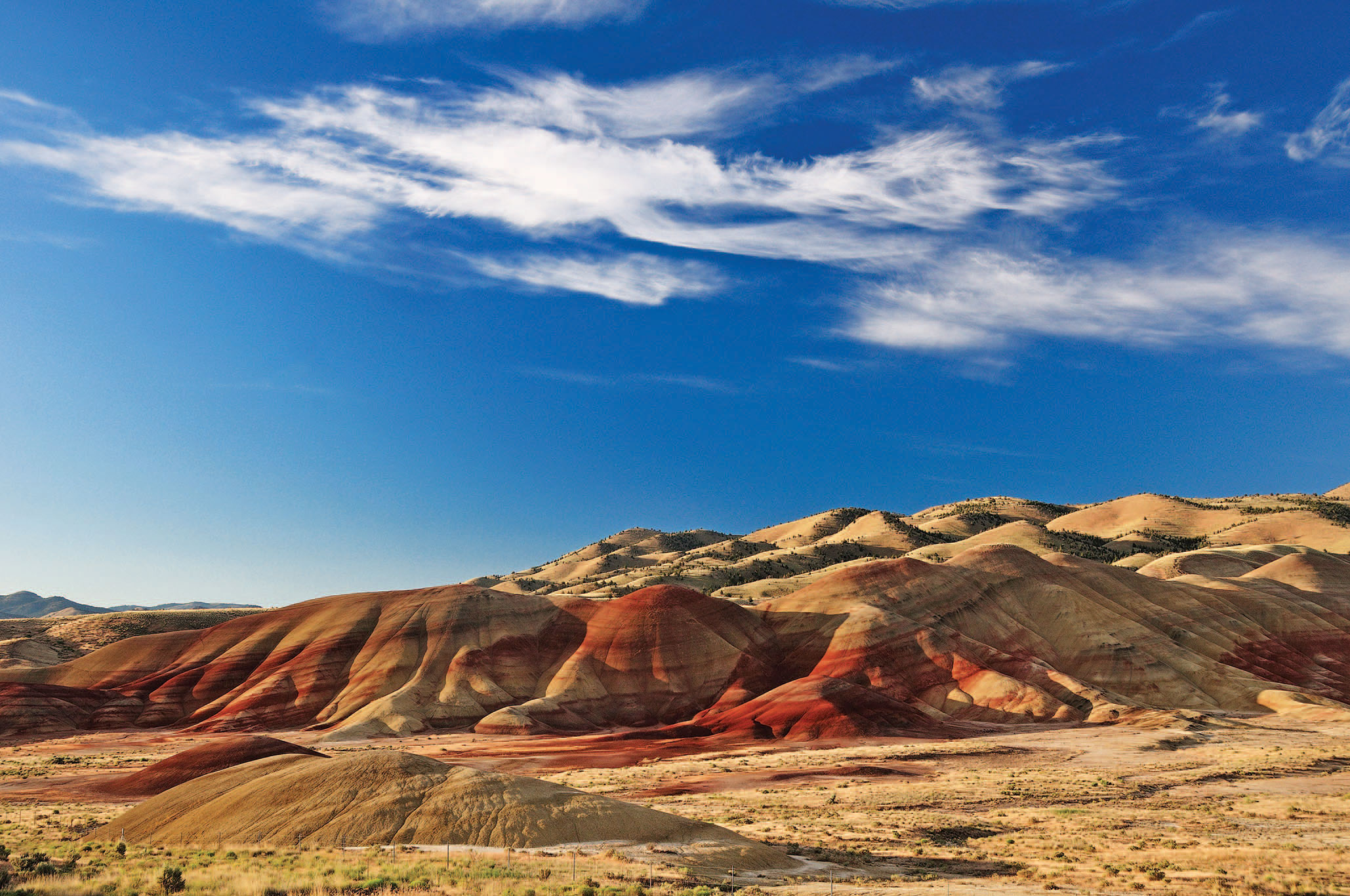
With a population of 160 souls, Spray occupies a land of sagebrush, juniper, rim rock, and ponderosa pine. Its rodeo grounds are framed by the Blue Mountains of the Umatilla National Forest. Perhaps because they spend the winter seeing so few unfamiliar faces, locals don’t tend to be tight-lipped with visitors. Spray and other barely there settlements of Wheeler County — also home to the magnificent red-clay Painted Hills — are some of the most relaxing and amiable places in the state.
Long Division
From Spray it’s a quick drive north to Oregon’s pièce de résistance: the Columbia River Gorge. Extending more than 100 miles along the run that forms the Oregon-Washington border, it’s the largest national scenic area in the United States. In 1805, by the time Lewis and Clark floated down this portion of the Columbia, Native Americans had been living in the area for 10,000 years.
My favorite way to take in the gorge’s sheer vertical walls is east to west, hitting the road around Umatilla at sunrise. Both sides of the gorge are stunning, but I like driving the Washington side, along Highway 14, which follows the river. This allows a full view out the driver’s window of the Oregon side, which traverses a landscape from high desert to alpine meadow to rainforest.
Dams have turned the river’s once-treacherous waters into a series of docile reservoirs. The Columbia River Basin — which spreads into neighboring states far beyond the gorge itself — provides more than 40 percent of total U.S. hydroelectric generation. Yet even with all the environmental changes, when the early light glows across the ancient rock crevices towering above the river, it’s hard not to feel something in common with those early peoples and explorers.
I usually dip back into Oregon at the Bridge of the Gods, a high cantilevered span from the 1920s that also serves as the Pacific Crest Trail link for hikers crossing between the two states. The bridge is a point of pride to Oregonians. It costs just two bucks to cross, and from the middle of the river you get one of the best views in the state down either side of the gorge. Fans of the movie (and book) Wild will recognize the bridge from the final scene of the film.
“The Bridge of the Gods, I think, is significant to so many people who live in this region,” author Cheryl Strayed has said. “It has such personal meaning to me because of course it’s the place where I ended my 1,100-mile hike on the PCT.”
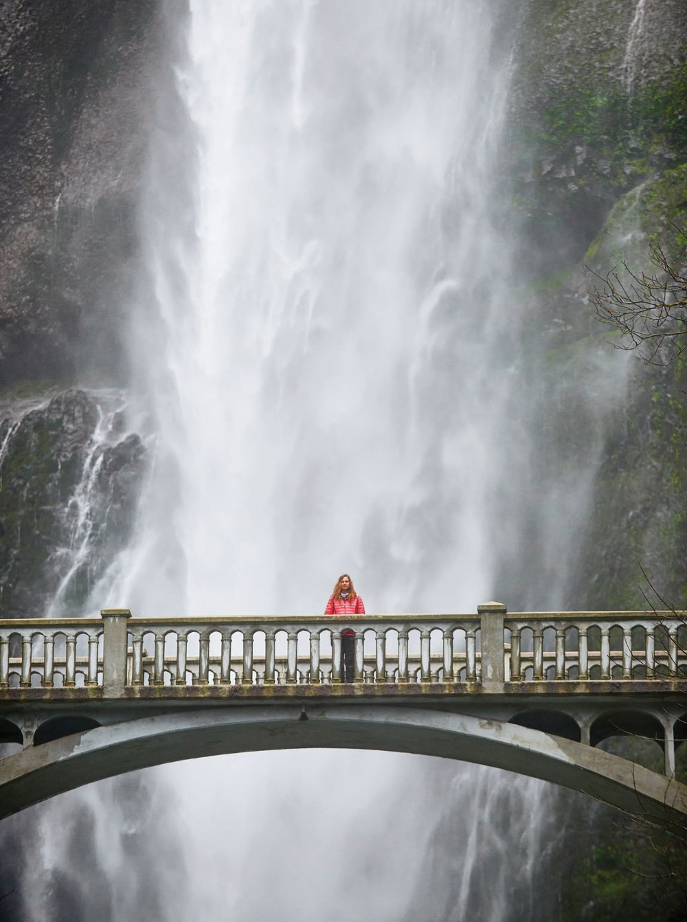
Symbolic as it is for Strayed, this sacred spot is hardly the end of most Oregon trails. From here, in fact, Oregon travelers must contemplate a nearly impossible raft of choices including such heavy hitters as Multnomah Falls, the wine country, Bend, Crater Lake, Hells Canyon, and dozens more iconic sites and experiences.
But since most road trips usually end about where they started, I’ll bring this one back to the coast, just north of Cannon Beach, to Fort Clatsop, near Astoria. Here, Lewis and Clark finished their own odyssey down the Columbia River Gorge.
“Ocian in view! O! the joy!” wrote Capt. William Clark in his journal on November 7, 1805, when, after trekking 4,000 miles across North America, the expedition party reached the Columbia River estuary and eventually those pristine Pacific beaches.
As you’d expect, exhibits at today’s Lewis and Clark National Historical Park present a fascinating look into the past. But the whole place embodies the spirit that makes Oregon special to this day. Like the rest of the state, these replicas of the humble log dwellings where Lewis and Clark hunkered down for the winter belie a larger message of grandeur and connection to a still mostly primeval land that, to echo the promise of Gov. McCall, we cannot live without as Oregonians.
From the July 2017 issue.


