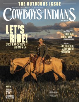


Through mud, mist, and billion-year-old stone, we hiked Missouri’s wild heart — discovering its tallest peaks, richest stories, and deepest history.
Welcome to Bucket List — our new series of social-first adventures exploring the most unforgettable experiences the West has to offer. From scenic hikes to surprising thrills, we’re chasing the places and moments that stick with you.
First up: hiking the Ozark Trail to see Missouri’s tallest mountain, its tallest waterfall, and the rugged beauty of the ancient St. Francois Mountains
Three hours after my friends and I were supposed to put our boots on the Ozark Trail, rain fell in unrelenting sheets. Grumbling thunder and jagged sprites of lightning told us to stay where we were, safely under cover at the welcome center at Johnson’s Shut-ins State Park in east-central Missouri.
Water shaped the Ozark region over the last 1.4 billion years. I was OK with it if it delayed my hike for another hour or two.
Along came Nick Cody, the superintendent of the park. Even while rain splashed down, he encouraged us to hit the trail (after the lightning ended), verifying that a wet day on the trail beats a dry day at home.
I had plotted and planned and schemed and dreamed about this Ozark Trail hike for months, and Cody blew up my itinerary in an instant, in a good way. He told us of a dazzling new mountain lake fishing spot like those that dot Rocky Mountain National Park. The lake is not on most maps, so I didn’t know about it, and neither does almost anybody else.
“It’s a beautiful little spot,” Cody said. “Undeveloped. It’s a hidden gem.”
My to-do list was already full of beautiful little spots and hidden gems that make the OT a bucket-list destination—Missouri’s tallest mountain (Taum Sauk) and highest waterfall (Mina Sauk) among them. I added the Brand-New Mountain Lake Fishing Spot (a six-mile roundtrip) to the list.
Covering 430 miles across Missouri, the OT sits 80 miles west of the Mississippi River. The west’s first great trail, it slices through the St. Francois Mountains, which are among the oldest on earth. Formed by volcanic eruptions 1.4 billion years ago, they are 17.5 times older than the Rockies.
I could not wrap my brain around those numbers. They haunted my every step on the Ozark Trail as I hustled from rocks to dirt to creeks to roots. The immediate present, ancient past and eras in between collided repeatedly, and the fishing spot Cody pushed us to explore was the most obvious example: Tucked in a mountain range that is 1.4 billion years old, it was so new it wasn’t even open yet.

The Ozark Trail twists through arduous climbs atop ancient volcanic rocks, hard-packed dirt in hardwood forests, wide-open glades, gurgling creeks, trout-filled rivers and more. It is unique in that it comprises four unconnected parts as opposed to a “straight” line. Even the longest part is not a traditional point to point. Instead, it looks like a T drawn by a toddler.
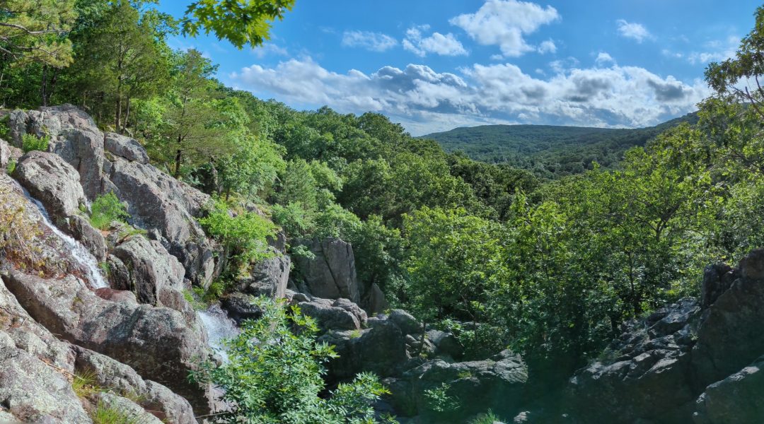
When the rain finally ended, we said goodbye to Cody and began our hike on the 12-mile section that starts at Johnson Shut-ins State Park and ends at Taum Sauk Mountain State Park. That is widely considered the best stretch of the Ozark Trail and the best hike in Missouri. It connects three of Missouri’s most iconic geographic locations: Johnson Shut-ins, Mina Sauk Falls, the state’s tallest waterfall; and Taum Sauk Mountain, Missouri’s highest elevation point.
A shut-in is a small gorge. As the east fork of the Black River flows through relatively soft dolomite bedrock, it carves a wide valley. Then the river hits the much harder igneous rock, and the valley gives way to narrow channels — the water is “shut in.”
Early last century, humans saw the shut-ins and thought, Cool! A natural water park! The state built a campground around it, and swimmers flock there every summer to frolic in God’s own waterslides.
To walk along the shut-ins is to hear water shouting as it s-l-o-w-l-y erodes that igneous rock. To swim there is to hear children, and maybe yourself, squealing in delight.
In December 2005, a reservoir on Taum Sauk Mountain broke, sending 1.3 billion gallons of water into Johnson Shut-ins State Park. The deluge destroyed the campground, though nobody was injured.
The area was cleaned up, and the campground was rebuilt a few miles away. You can still see damage the water caused as it scoured the landscape down to the bedrock along one brutal path. It looks like someone gave the forest a reverse mohawk … and it’s starting to grow back. My friend Tim, who has hiked that stretch of the OT four times, stopped at an overlook and said the scour (as it’s known) gets a little greener on every return visit.
All it needs to fully recover is more time and water.

In the 67 miles I’ve hiked across three adventures on the Ozark Trail, time has played unending tricks on me. It slowed down and sped up based on the ground under my feet. One mile was dirt, and I clicked it off in 20 minutes, the next was all rocks and took twice as long.
I stopped to catch my breath, one foot on a rock, one on the dirt, checked my watch to calculate how much longer we had to go before we set up camp … and looked out at mountains that Native Americans lived in going back 14,000 years.
The Osage tribe was the most populous and powerful when settlers arrived in the early 1800s. Others lived here, too, including the Sauk tribe, from whom Mina Sauk Falls and Taum Sauk Mountain derive their names.
The 12 miles between Johnson Shut-ins and Taum Sauk Mountain were by far the most difficult because of rocks, elevation change and treacherous creek crossings. Making matters worse: Heavy rain turned the trail itself into a creek in some areas.
View this post on Instagram
Just as water shaped this region throughout history, its presence (and absence) shape how we experience it day by day. Rain provided the trail’s greatest challenge, and it also provided its greatest joys. I arrived at the bottom of Mina Sauk Falls wet-footed, sweaty and sore from a comical spill (caused by a wet rock!) that ended with me landing on a rock on my ass and my pole and water bottles strewn about the trail.
I forgot all that as I looked up, tracing the water to its source 132 feet above me. Rocks and trees obscured the view, but cascading white flashes exploded behind them. In dry seasons, the falls slow to a trickle. Because of the heavy rain, the falls sparkled like endless fireworks.
We climbed alongside the narrow falls, hopscotching across boulders, stopping on rocks close enough to get sprayed. The raging water pounded the ancient volcanic rhyolite, white noise run through nature’s amplifier.
A short and treacherous hike from the top of Mina Sauk Falls took us to the top of Missouri. Taum Sauk Mountain stands at 1,772 feet. Trails of various difficulty and lengths lead to and from the summit. Or you can park at Taum Sauk Mountain State Park and walk there in a few minutes.
There’s a plaque at the “peak,” though it’s so flat it seems like the plaque could have been put anywhere within a 100-yard circle or more. It would (almost) have been a letdown if not for a glade nearby that gave a nearly panoramic view of the undulating St. Francois Mountains.

I hike because every step is a new discovery. Every inch on the Ozark Trail was new to me, and I lapped it like a panting dog, especially the glades.
Glades are open, rocky areas within a forest. Usually facing south/southwest/west, they are marked by shallow soil and/or exposed bedrock. The lack of trees makes them seem like a different environment, more akin to a prairie or desert or a mix of the two.
To arrive at a glade on the Ozark Trail is to realize that whoever invented scenic overlooks alongside highways cribbed that idea from nature. Over and over, I walked, eyes down and scanning for rocks, sweating even under tree cover, only to sense the light change. I looked up, and gone were the trees that once blocked my view. In their place was a grassy field dotted with boulders and beyond that a rolling valley, and beyond that a mountain.
I straddled a delicate balance between traipsing joyfully and trespassing ignorantly. I wanted to walk up to the edge to get closer to that valley, to smell the threatening rain, to feel the cool mist floating between me and the mountain on the other side. I wanted to veer off trail to discover something new to me—be it a creature or a wildflower or a view. Sometimes fences prevented that, and when they didn’t, I didn’t want my yearning for discovery to be to the glade’s detriment. So I looked but didn’t touch and moved on.
Lizards and snakes and tarantulas and creepy crawling things unnamable sunned themselves until crunching footsteps sent them scurrying. At one glade I side-eyed a collared lizard—which gets its name from the black stripe around its neck—as it lounged in the sun. It was the size of a kitten. I surreptitiously pulled out my phone, nonchalantly opened the camera, bent down … Wait! No! Come back!
Some glades were long and deep, bigger than a football field. Others closed as quickly as they opened. I entered one that closed and reopened and closed and reopened. Glade, trees, glade, trees, like walking through a shipping warehouse where every other bay is closed. I suspected that it used to be one giant glade, and that the trees that now separate it are evidence of the creeping arrival of human development.
I sent video from that area to Casey Brewster, a conservation biologist at the University of Arkansas and glade expert, and he agreed with my assessment. I was right in a way I didn’t expect.
As great as Ozark glades are, they used to be more and bigger, even much bigger. While glades now seem like islands in a sea of hardwood forest, it used to be the other way around. Said Brewster via email: “That section of the Ozark Plateau would have been dominated by that landscape, with only smaller, interspersed sections of mature hardwood forest. In short, what we call ‘glade’ habitat would have been part of the dominant landscape.”
The most commonly cited cause of the decline of glades is fire-suppression polices that allowed cedars to overtake them. In this case, it wasn’t cedar but blackjack and post oak. Regardless, poor fire-suppression policies are only part of the story. The rest, Brewster says, includes, “European settlement, agriculture, urbanization and land management with goals other than preserving/conserving natural ecosystem function.”
Cedar removal has reclaimed some glades, especially near Taum Sauk Mountain, and better fire and land-management policies have halted their decline.

They are called bent trees, or thong trees, or trail trees. They grow normally for a few feet, make a 90 degree turn parallel with the ground, then a 90 degree turn up toward sunlight.
Sometimes they grow like that. And sometimes Native Americans tied saplings down to make them grow like that as markers. I saw many of them on the Ozark Trail.
I seriously doubt any of the ones I saw were old enough to be the handiwork of Native Americans. But I bring them up because they offer another example of the confluences of different eras. Native Americans used them to navigate. Until a few years ago, hikers used blazes on trees and cairns in glades. Today we use our phones … except mine rarely worked because the trail is so remote.
I got lost once, had to double back for blazes multiple times and paused to verify cairns ahead of me before entering glades time and again. And so it was that when we left the main trail to find the Brand-New Mountain Lake Fishing Spot, we did so cautiously.
View this post on Instagram
Departing the main trail from a big glade, we turned left at an old logging road, turned left again when that road entered the woods, and followed it along a labyrinth route, with brand new red blazes leading the way.
My sense of discovery, finely tuned by the glades, spiked now as I approached the hidden lake. I found a rabbit’s jawbone on the trail. What befell that poor creature that the last of its face wound up there? I was equally curious (and also massively annoyed) when Tim pointed out a pickup grille nailed to a tree. Nothing ruins a deep, remote reverie like automotive litter.
Still, I couldn’t help but wonder whose truck it was and why in the world did the owner nail it to a tree way the hell out here and more specifically why that tree?
Down, down, down we went until finally, water twinkling through the trees heralded the Brand-New Mountain Lake Fishing Spot.
We made one more sharp left, and the 62-acre Fire Pit Lake opened before us. Ringed by oak, hickory and shortleaf pine, it rippled gently. A soft breeze played a lilting rhythm on my face. We filtered water from the lake and drank our fill.
The campsite’s fire ring was still colored metallic gray. The clearing around it—flat, grassy, hugging the shore—begged to be camped in. We had time, but not that much.
We lingered long enough for the lake’s peaceful otherness to swallow us. Time played tricks on me, again. I imagined nobody in the last 1.4 billion years had stood where I was. Deep in my bones I wanted that to be true even as I knew it wasn’t. We stayed until the gray clouds threatened rain, signaling that it was time to leave.

PHOTOGRAPHY: Courtesy of Matt Crossman