Ten more of our favorite national parks to put on your Western vacation list.
In 2008, Cowboys & Indians celebrated its 15th anniversary by honoring its favorite 15 national parks in the West. Needless to say, there was some agonizing during the selection process. Tears were shed. Lines — and a few six-shooters — were drawn. Rules were broken (we ended up including a national seashore). And then, of course, readers were good enough to ask us how in the world we could come up with a National Parks Dream Team without including Zion in the lineup? Or Denali? Or North Cascades? What were we thinking?
Needless to say, we knew we’d be running a sequel before our 30th anniversary to make things right for everyone — which (spoiler alert!) we haven’t. Not at all. Turns out, choosing the “best,” grandest, most awe-inspiring, life-affirming chunks of our National Park Service’s 84 million acres isn’t just a messy job. It’s a downright impossible one.
So, first, our apologies. The following Top-Ten-List-of-National-Parks-in-the-West-We-Shamelessly-Neglected-to-Honor-the-First-Time-Around still suffers from some stunning omissions. Nonetheless, these picks represent, in the words of Theodore Roosevelt, “one of the best bits of National achievement which our people have to their credit.” See them. Marvel over them. Bask in the enjoyment they bring and the majesty they display. And commit yourself not just to visiting more national parks but to protecting and preserving them. They are, after all, yours.
GRAND TETON NATIONAL PARK
Northwestern Wyoming | Established 1929 | 309,995 Acres
Only in a state that also claims Yellowstone (just up the road) can a park of this caliber play second fiddle. Which, of course, it doesn’t at all. Dwarfed by Yellowstone in size only (okay, and geothermal activity and bison population), Grand Teton National Park wins its own contest hands down for sheer alpine beauty. Commuters to Jackson (our vote for best national park-adjacent community) get an eyeful of it when descending to an airstrip inside the park’s boundaries. Suddenly, there it is — one of the few tear-inducing views from a cramped window seat: the unmistakable Teton Range. A row of steep granite spires punched out of a bucolic landscape bordered by the winding Snake River; pockets of glacial lakes; sprawling forests; and meadows full of elk and bison, with the occasional black or grizzly bear — few first impressions in the National Park System can match this one. Of course, that grand view begs for any of several personality-tailored close-ups. A sunset paddle down the Snake River. A mellow mountain bike spin past grazing pronghorn on the back roads of Mormon Row. A boat shuttle to the west shore of Jenny Lake and day hike up to wildflower-fringed Lake Solitude. A pint of Teton Ale with front-row mountain views from a porch rocking chair at Jenny Lake Lodge (ask about their guided horseback rides through the park for registered guests). Or a coveted (and technical) climb with Exum Mountain Guides to the park’s top floor, the wind-swept summit of 13,770-foot Grand Teton, where the ultimate bird’s-eye view comes without a tray table or seat belt sign.
SEQUOIA AND KINGS CANYON NATIONAL PARKS
Central California | Established 1890 | 865,257 Acres
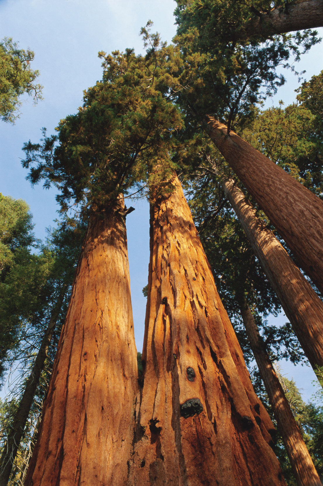
If it looks like we cheated by squeezing two parks into one space, then so did the National Park Service, which runs these contiguous High Sierra gems as an inseparable pair. As well it should. Doing otherwise feels about as wrong as honoring the Grand Canyon without the Colorado River, celebrating Roy Rogers without Trigger, uttering the name Laurel without Hardy. You get the point. They’re a package deal — and, more important, can be easily experienced together in one incredible trip. Sequoia is the second-oldest national park in the country; only Yellowstone is older. Kings Canyon, its not-quite-as-famous but equally impressive neighbor just north along the Generals Highway (one of the nation’s great scenic drives), has an edge for solitude seekers as it draws about half the visitors that Sequoia pulls in. Taken together, Sequoia and Kings Canyon claim some of the most stunning glacier-gouged imagery in California’s signature Sierra Nevada range — nearly a million acres of gaping canyons, snaking rivers, glimmering alpine lakes, towering conifer forests, and looming granite peaks capped by 14,496-foot Mount Whitney, the highest summit in the lower 48. The dual parks’ most famous inhabitant is Sequoia’s General Sherman Tree, aka the largest living tree on earth. At 275 feet tall and 102.6 feet in trunk circumference, the 2,000-plus-year-old sequoia is the centerpiece of what legendary naturalist John Muir dubbed “the Giant Forest” when he surveyed its resident grove of unimaginably humongous trees more than a century ago. Our suggestion: Pay your respects to General Sherman and then escape the gawking crowds at one of several quieter campgrounds in Kings Canyon’s Grant Grove and Cedar Grove areas, where the imagery continues with a fraction of the foot traffic.
OLYMPIC NATIONAL PARK
Northwestern Washington | Established 1938 (1909 as a national monument) | 922,650 Acres
A recent influx of younger visitors to the crashing coasts, craggy peaks, and neck-craning rain forests of Olympic National Park is more than just proof that a hit series of teenage vampire novels (Stephenie Meyer’s Twilight saga is based in the satellite town of Forks) can boost a national park’s cool-meter rating. It also confirms that there’s something for absolutely everyone here. Occupying the central core of Washington’s gargantuan Olympic Peninsula, this enormous (and enormously varied) park is too large to digest in one visit. Beachcombers can tromp the wave-battered, log-strewn 73-mile shoreline with an eye out for gray whales, sea otters, and bald eagles. Jungle walkers can vanish into a primeval sanctuary of moss-draped alders and hulking spruce trees at Hoh Rain Forest, one of the finest remaining examples of temperate rain forest in the country. Peak-baggers can trek through cathedral valleys and up into the park’s magnum opus, the Olympic mountain range. Lodge loafers can bask in a steaming mineral pool at Sol Duc Hot Springs Resort or check in at three other rustic retreats within the park. Easy riders can skim the park’s rim along Highway 101 through a corridor of conifers tall enough to shrink a Harley into a Hot Wheel. Where does one begin? Our suggestion: with a winding, easy-grade 17-mile drive up Hurricane Ridge Road from sea level in Port Angeles (the route begins on Race Street) to a 5,200-foot-high lookout at the top of Hurricane Ridge. Gaze from the Olympics to fields of flowering meadows to the Strait of Juan de Fuca. Taste your first full view of this huge place. Rub your eyes. Repeat.
GUADALUPE MOUNTAINS NATIONAL PARK
West Texas | Established 1972 | 86,416 Acres
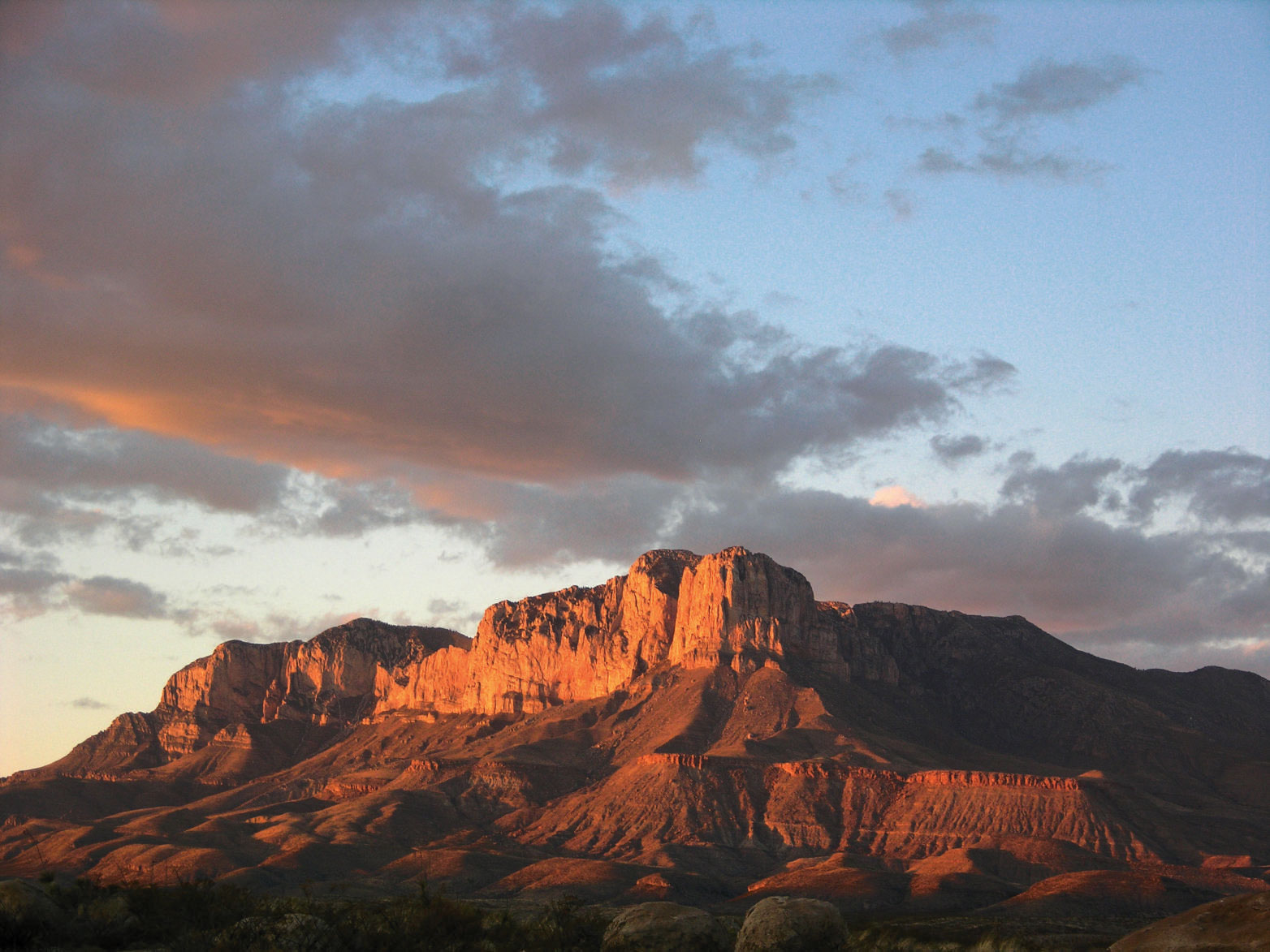
Amazingly, this isolated expanse of ancient wilderness — referred to by park personnel as “an island in the desert” — isn’t the most off-the-beaten-path national park in the West. That distinction goes to its West Texas neighbor Big Bend, hiding about 200 miles south. But in such an out-there edge of the country — heck, the world — who’s really keeping track? Of course, there’s much more to this easily missed place than solitude, the state’s highest point (Guadalupe Peak, 8,749 feet), great fall colors, some killer geology, and two-for-one potential with neighboring Carlsbad Caverns National Park 42 miles up the road. One of the finest ancient marine fossil sites on earth, the entire park was once a great underwater reef teeming with Permian life before the ocean evaporated and several million years of geological wizardry ran its course. The end result is a daunting yet oddly harmonious landscape of deep limestone canyons, lush glades, and sun-baked dunes spread across layers of disparate ecosystems that range from barren desert to riparian woodland to alpine forest. The place has outlasted a turnstile of human residents: Prehistoric hunter-gatherers, Apache tribes, Spanish conquistadors, Buffalo Soldiers, homesteaders, miners, and die-hard stagecoach operators have all come and gone. But this forbidding spot continues to support a surprising amount of life: 90 species of butterflies at last count, javelina families, and the odd mountain lion and bear. There are more than 80 miles of hiking trails, including through the bottom of and to the ridges surrounding McKittrick Canyon, a verdant desert oasis (and a geologist’s dream) at the northeastern entrance of the park that’s been called “the most beautiful spot in Texas.” For an unforgettable day on horseback, ride from stock corrals (at Frijole Ranch and Dog Canyon) into one of the most timeless, equine-friendly backcountries anywhere. Bring your own bronc.
PETRIFIED FOREST NATIONAL PARK
Northeastern Arizona | Established 1962 (1906 as a national monument) | 108,000 Acres
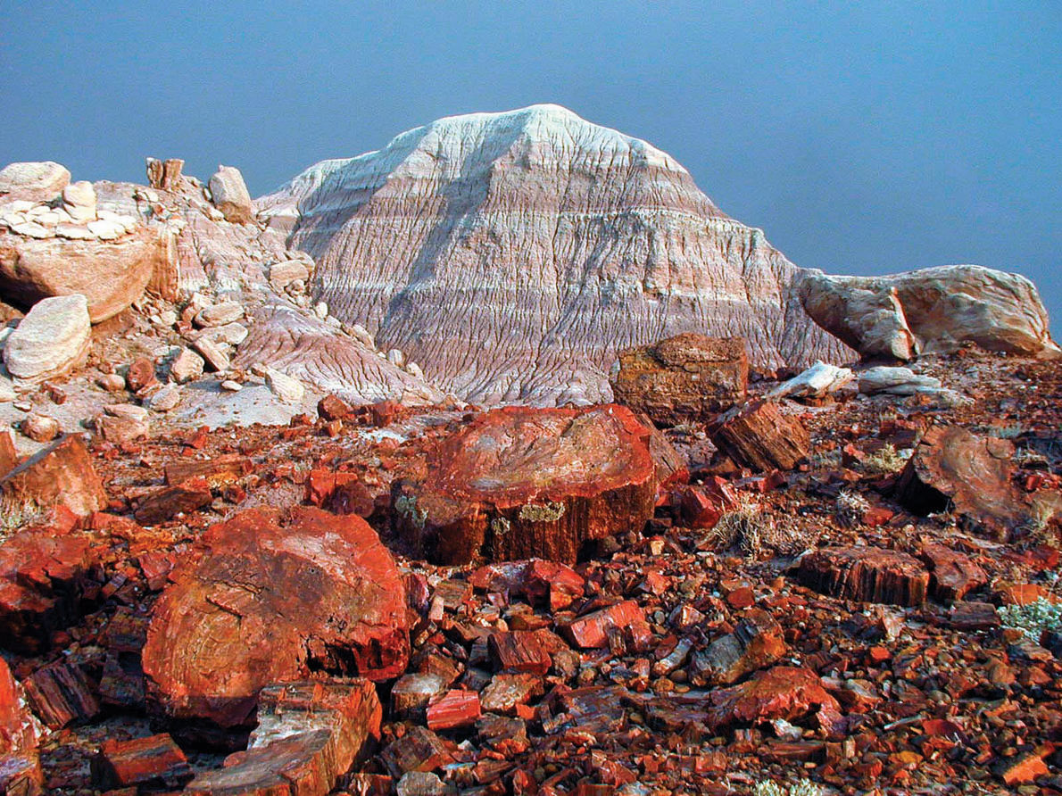
If there’s a park on this list that best confirms the folly of owning a watch, it’s this one. Time is so clearly, so starkly, so beautifully happening on a different scale here that getting your head around the age of this clock-busting fossilized “forest” site is about as easy as conceptualizing a light-year. Back in the Triassic Period, when Arizona was straddling the equator and ancestors of all those Jurassic brutes were roaming the earth, groves of 200-foot conifer trees stood in this very spot before being buried in volcanic ash, embalmed with silica, and literally turned to stone. About 220 million years of continental drift and geological shift later, Petrified Forest National Park marks what looks like the conclusion of that whole long chapter, which of course never ends. Yes, the most obvious draw here is the petrified wood (and, no, there aren’t any free samples — removing it is a crime that folks do get busted for). This is one of the world’s richest concentrations of the hard stuff. It’s strewn across this pastel-hued expanse of mesas and buttes on the southern rim of the Colorado Plateau, sharing space with the aptly named Painted Desert. Technicolor cross sections of it have been polished and displayed at the park’s Rainbow Forest Museum. Impressive hunks rest on the neighboring Long Logs Trail — and virtually everywhere else you look. Blocks of it were used in the construction of a small eight-room pueblo called Agate House. But that’s just part of the story here. Absorbed into this still life landscape are ancient dinosaur fossils, strange geological wonders, and more than 650 ancestral Pueblo Indian sites ranging from tiny shelters to the 100-room ruins of Puerco Pueblo. Really, where else can you experience more than 13,000 years of human history alongside a long-retired stretch of old Route 66, half-buried in a field of shortgrass prairie?
BLACK CANYON OF THE GUNNISON NATIONAL PARK
Western Colorado | Established 1999 (1933 as a national monument) | 30,750 Acres
Is there a cooler name in the National Park System? Seriously. Say it out loud and you may not be able to stop. Of course, that alone isn’t enough to merit this young and relatively underappreciated park’s place on a C&I Top 10 list. What’s hiding behind the nifty name tag? Arguably the most dramatic views in any park in the system — at least in a purely vertigo-inducing sense. There are bigger canyons out there, to be sure. And broader ones. Deeper ones. Longer ones, although Black Canyon of the Gunnison’s 53 miles (shared with the Curecanti National Recreation Area and the Gunnison Gorge National Conservation Area) are formidable. What this shocking gash in the planet’s crust possesses are all three elements in one haunting package. It’s very deep (half a mile). It’s very narrow (40 feet in some places). It’s very, very sheer (as in vertical). Its dark walls of schist and gneiss contain the tallest cliff in Colorado (2,250-foot Painted Wall). Save for a handful of dauntless paddlers and rock climbers who better know what they’re doing, its barely penetrable wilderness is some of the most undisturbed on earth. Even the sun is a little leery of this place, its rays dipping into the park’s tapered jaws only briefly each day. But this shouldn’t dissuade you from peeking into Colorado’s wildest abyss on a number of inviting hiking trails from the top. On the busier South Rim, the Warner Point Nature Trail loops for a mile and a half through groves of mountain mahogany, pinyon pine, and juniper with several panoramic overlooks. The big payoff on the quieter North Rim (at least a two-hour drive from the South Rim) is the fittingly named Exclamation Point — one of the most knee-wobbling overlooks you’re likely to experience anywhere. For a journey at river level, try the Morrow Point Boat Tour; led by a park ranger, it meanders for an hour and a half downstream in neighboring Curecanti National Recreation Area through the astonishing narrows of the upper Black Canyon.
LAKE CLARK NATIONAL PARK & PRESERVE
Southwestern Alaska | Established 1980 (1978 as a national monument) | 4,050,000 Acres
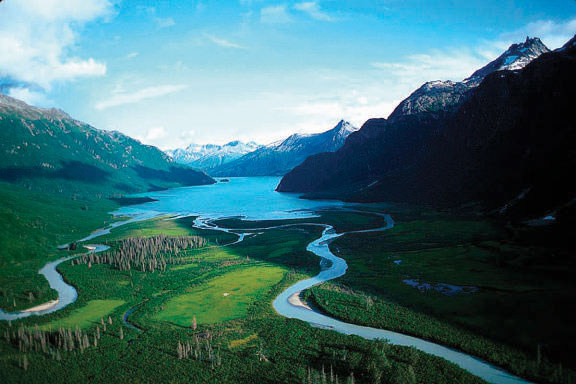
If a national park could make a Top 10 list for the sheer effort involved in simply getting there, this one would be high in the running. But what’s the real payoff for flying to Anchorage, boarding a small plane for a one- to two-hour flight to park headquarters at Port Alsworth (there are no roads servicing Lake Clark), and then boarding yet another puddle jumper to your specific put-in spot somewhere in these 4 million rugged, trailless acres? Nothing short of experiencing the epitome of Alaskan wilderness. Tucked between the Alaska Range and the Cook Inlet, Lake Clark could be described as an encapsulation of every other better-known national park in the state. It may not boast the continent’s highest mountain (like Denali), the area’s best-known volcanoes and one of the world’s largest brown bear populations (Katmai), or the Alaska coast’s most impressive glacial waterways (Glacier Bay). What Lake Clark does have amounts to the meal-size sampler platter: alpine imagery that could pass for the northern Rockies; salmon-stuffed rivers and 400-foot-deep turquoise glacial lakes; prime grizzly watching along gorgeous stretches of coastline, waterfalls, rolling tundra foothills, and a pair of active volcanoes. There’s a historic Native Dena’ina Athabascan trail that’s been around for centuries, and a famous homesteader’s cabin on Upper Twin Lake built and resided in for 32 years by local legend Dick Proenneke (subject of the book One Man’s Wilderness: An Alaskan Odyssey and documentary Alone in the Wilderness) that remains one of Alaska’s great pilgrimage sites. Best of all, there’s practically no one here. About 5,000 people visit Lake Clark annually, and with just four miles of maintained trails in the entire park, there are no paths herding everyone together. Go on foot, in a kayak, by raft, or with fishing gear. But go with a topo map, compass, and some serious wilderness savvy. Or go with a reliable outfitter like Alaska Alpine Adventures, which runs paddling and hiking trips throughout the park.
HAWAII VOLCANOES NATIONAL PARK
Island of Hawaii | Established 1916 | 333,086 Acres
One of the oldest parks in the system (created more than 40 years before Hawaii became a state), this place was getting glowing reviews as early as 1866, when Mark Twain reported on an erupting Kilauea Volcano for the Sacramento Daily Union. Expecting an anticlimax, the writer giddily described “a thousand branching streams of liquid and gorgeously brilliant fire ... like a colossal railroad map of the State of Massachusetts done in chain lightning on a midnight sky.” Today, this overachieving lava land on the windward side of Hawaii’s Big Island (home to two of the world’s most active volcanoes and the longest-running rift-zone eruption in recorded history — 27 years and counting) is no less impressive, albeit a tad busier. Two million annual visitors come to watch Kilauea belch enough liquid rock to resurface a 20-mile-long two-lane road every day. Thankfully, losing the crowd in this charred, churning, ever-changing wilderness — laced with nearly 70 miles of scenic roadways and more than 150 miles of marked trails — is pretty easy. Camp in one of two drive-in campgrounds. Drive along Chain of Craters Road to the route’s new terminus, the site of a lava-flow crossing in 2003. Tromp across ash dunes, through tropical rain forests, past a moonscape of sulfur vents. Check in to the same historic lodge (Volcano House, Hawaii’s oldest continually operated hotel, which will reopen in early 2011 after restoration) that Twain raved about in his article. And be here at night when the nation’s best natural fireworks show could take on a luminescence all its own, one that even the great Samuel Clemens could barely get his pen around.
CARLSBAD CAVERNS NATIONAL PARK
Southeastern New Mexico | Established 1930 (1923 as a national monument) | 46,766 Acres
What attracts humans to caves (allegorically or otherwise)? Unfortunately, Plato hasn’t returned our calls yet, but we can only assume that there’s something irresistibly primal about entering the jaws of a massive hole in the earth. Especially when it turns out to be a subterranean geo-kingdom like this one hiding beneath swathes of desert hills and cactus fields in a remote corner of New Mexico. The 110-plus caves of Carlsbad Caverns were famously “discovered” (Native Americans had long since known about them) in 1898 by local teenage cowboy Jim White, who reportedly noticed an eruption of bats pouring out of the ground while mending some fences in the Chihuahuan Desert. Ignored by the public for years in spite of White’s dauntless explorations with a homemade wire ladder and kerosene lantern, the caves eventually attracted larger notice. The area’s first cave tourists were lowered into the abyss in large guano mining buckets. Today, visitors to Carlsbad Caverns have it a little easier. There’s an elevator, an underground lunchroom, a handy audio guide, and wheelchair access in a portion of the park’s signature cave, The Big Room — one of the world’s largest underground chambers. Two self-guided tours lead through a network of scenic “rooms” with features such as Rock of Ages, Painted Grotto, Spirit World, and Bottomless Pit. Avid belly crawlers and budding speleologists can book a more involved guided trek that would do White proud. Every evening between mid-April and October, bat lovers can attend a daily exodus of Brazilian free-tails pouring out of the same hole White pioneered his way into and witness firsthand the very image that put this place on the map.
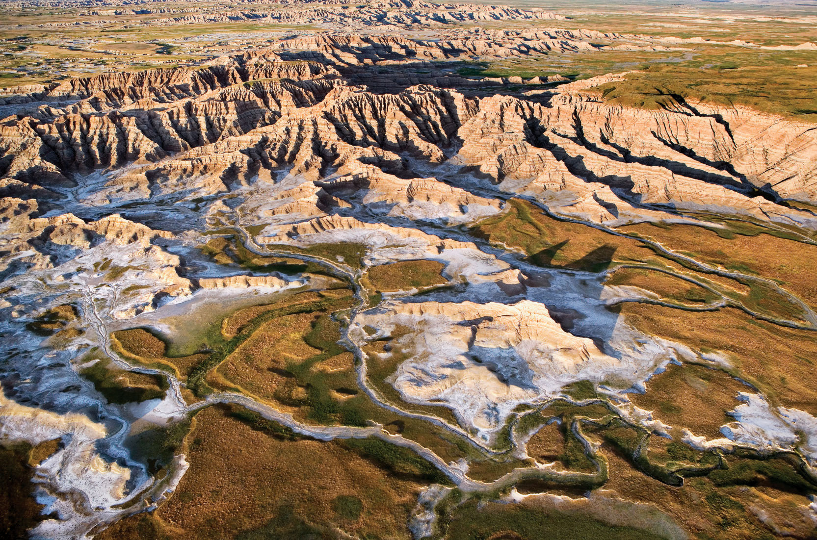
BADLANDS NATIONAL PARK
Southwestern South Dakota | Established 1978 (1939 as a national monument) | 244,000 Acres
Lurking in the shadows of nearby Black Hills National Forest, Mount Rushmore, and tourist-magnet towns like Sturgis and Deadwood, Badlands National Park doesn’t quite get the undivided attention it deserves. Most of the park’s million annual visitors spend about an hour here, detouring between Interstate 90 exits to glimpse the place’s wild earthen architecture from behind a windshield. But that’s good news for road-less-traveled types who decide to stay awhile, perhaps even long enough to experience a sunset or three in one of the continent’s most haunting geological imprints and neighboring prairie lands. Long ago the muddy floor of a prehistoric inland sea, Badlands’ secluded wonderland of buttes, pinnacles, and spires is the result of myriad sedimentary rock formations being sculpted by ceaseless wind and water erosion over the last half-million years. Embedded into this dry, rugged artistry — dubbed mako sica (“land” “bad”) by the area’s Lakota — are rich fossil beds of ancient marine species and some of the first mammals to roam the planet, including ancestors of today’s horse, pig, cat, and rhinoceros. Day trippers can start at the Ben Reifel Visitor Center, which houses several park exhibits and the recent award-winning film Land of Stone and Light before choosing from several short hikes right outside with dramatic views of the Badlands and White River Valley. Overnighters can camp at the foot of these hulking silhouettes and experience one of the starriest skies anywhere, or stay at the historic Cedar Pass Lodge. Horsemen can time travel through 64,144 acres of eroded spires and silent prairie in the park’s ultra-remote Badlands Wilderness Area, home to bison herds, bighorn sheep, black-footed ferrets (successfully reintroduced and one of the rarest mammals in North America), and a landscape that is reportedly eroding at a rate of about 1 inch per year. In fact, geological evidence indicates that these surreal landforms are scheduled to abrade back into nothing in another 500,000 years. So don’t put this one off.
From the May/June 2010 issue.


