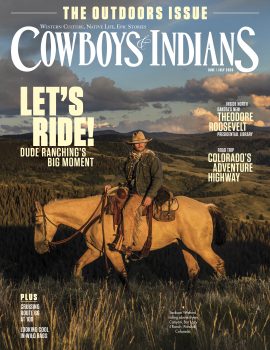


C&I partners with Off the Beaten Path to give you the Western summer road trip guide of your dreams.
The end of the trail’s not the thing — the trail’s the thing. Travel too fast and you’ll miss all you're traveling for. — Louis L’Amour
If you’re like us, at some point this summer you’ll be loading the truck and getting out of town. The wide-open byways of the West are one of the best places to find the freedom, adventure, and sense of discovery that can only come from that great American tradition, the road trip.
This country would be a lot better off if we all got out a little more, met some different folks, went to some new places. And like Louis L’Amour, we believe the magic of any trip lies in the journey.
That’s why we’ve partnered with Off the Beaten Path, a Bozeman, Montana, travel service, to bring you this local’s guide to three classic Western road trips. Each begins and ends in a terrific destination, but we’re not going to talk about them. We're focused on the in-between. The road there. The stops, the people, the history that you encounter along the way. That’s what you always remember most.
We promise we’re sharing some great recommendations, but please use this guide as a rough plan. Stop at places that aren’t on the itinerary. If you feel the urge, go ahead, pull in. See where that side road takes you. And remember, sometimes you find the best stuff by getting a little lost.
Road Trip: Monuments
Moab to Grand Canyon South Rim, Utah-Arizona
You’ll spend much of the day driving through a variety of spectacular Southwest landscapes, including Monument Valley, made famous by many a western film. The Navajo Reservation comes next, and last, but not least — the Grand Canyon.
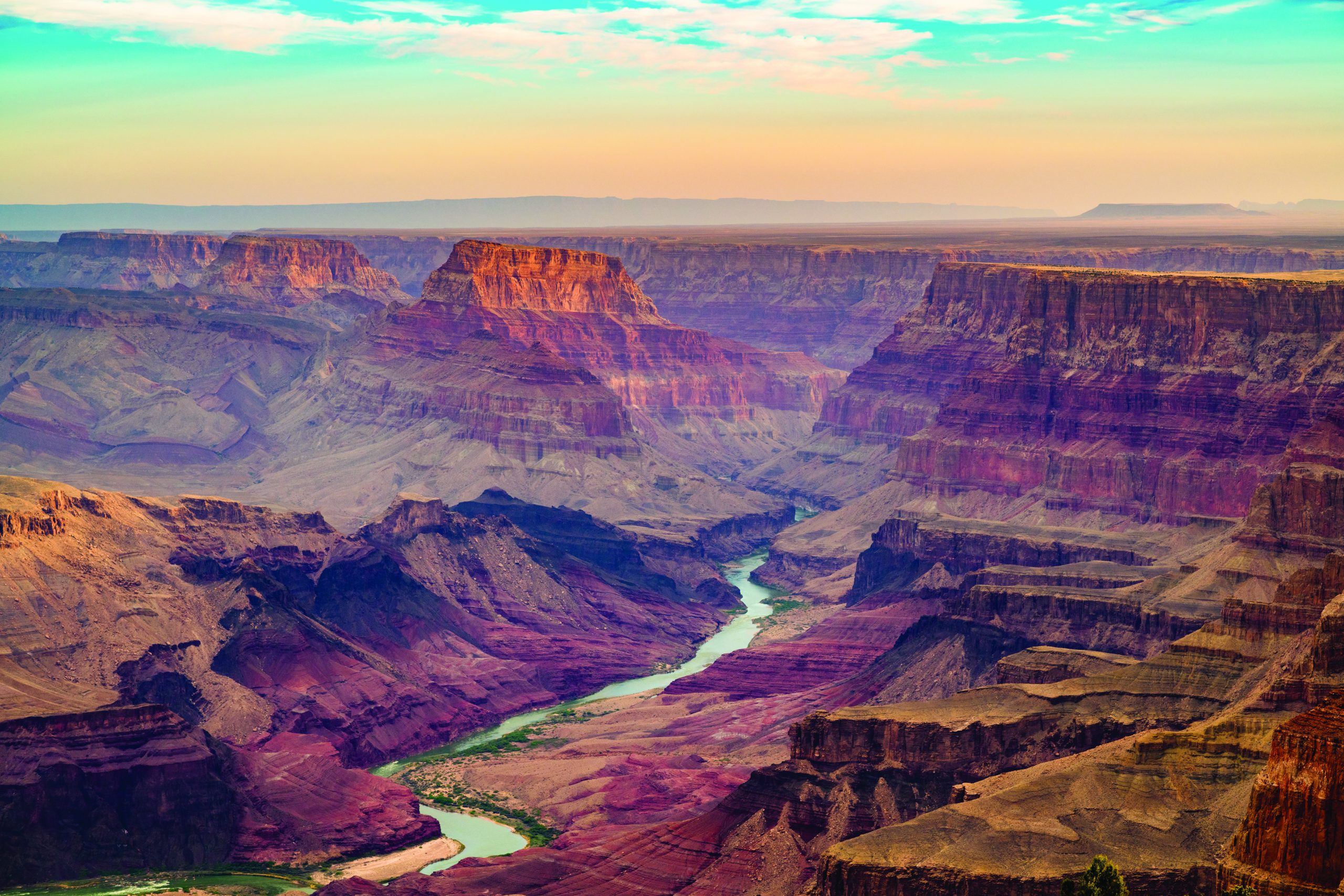 Grand Canyon from the South Rim.
The Route
The drive from Moab, Utah, to the Grand Canyon South Rim in Arizona is 322 miles and will take approximately five hours. From Moab, drive south on Route 191 and follow it for 104 miles, to Route 163. Go straight to continue on Route 163 southeast and follow it for 64 miles, crossing the Utah-Arizona border, to Route 160. Turn right onto Route 160 and drive west for 78 miles to Route 89. Turn left onto Route 89 and drive south for 15.6 miles to Route 64. Turn right onto Route 64 and follow it west for 53 miles to the entrance road for the Grand Canyon South Rim. Turn right onto the South Entrance Road and follow it to your destination.
Discovery and Exploration
Hole ’N The Rock (12 miles south of Moab, 435.686.2250) was Albert and Gladys Christiansen’s 5,000-square-foot, 14-room home, which was carved out of a large rock formation between the 1940s and 1960s, with Albert and Gladys as the main excavators (both have since passed on). Offerings at this kitschy Americana roadside attraction include a 12-minute house tour, general store, and trading post.
Wilson Arch (off Route 191, 24 miles south of Moab and 28 miles north of Monticello) is a large, elegant arch formation, also known as Entrada Sandstone. Named after pioneer Joe Wilson from nearby Dry Valley, it spans 91 feet and soars 46 feet. A short, steep 0.6-mile roundtrip scramble reveals the natural amphitheater behind.
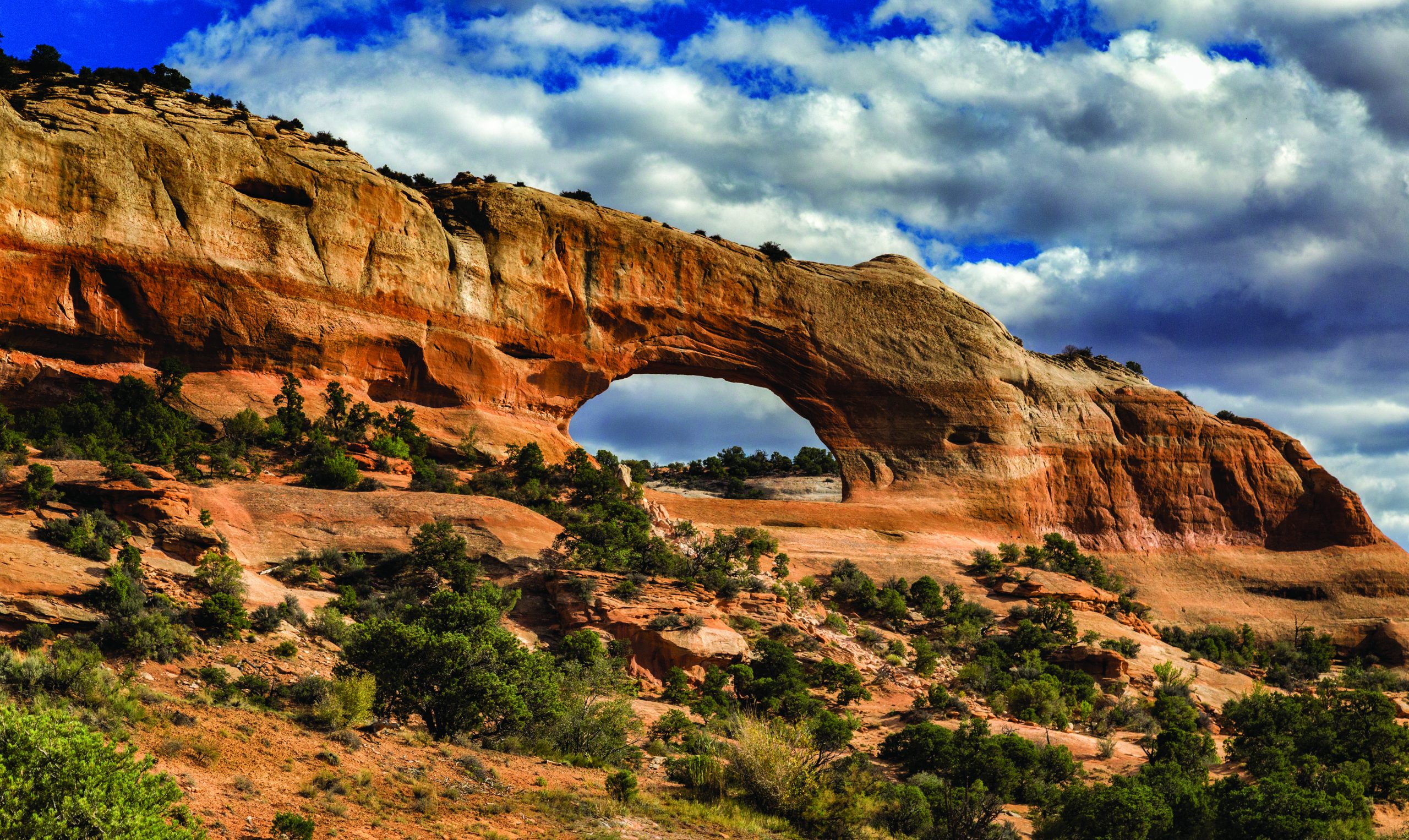 Wilson's Arch.
Canyonlands National Park’s Needles District (on U.S. Route 191, drive 40 miles south of Moab and 15 miles north of Monticello, then 35 miles on Route 211 to the end of the road) protects a collection of prominent needlelike natural features, tall pinnacles of rock created by the forces of erosion. The paved access road — Indian Creek Scenic Byway — takes you through a portion of Bears Ears National Monument, past Newspaper Rock, the Pothole Point Nature Trail, Slick Rock Trail, and viewpoints before the end of the road, where you’ll find The Needles Visitor Center (435.259.4711) and main trails to Chesler Park, the Joint Trail, Druid Arch, and more.
Newspaper Rock (on Route 211 en route to Needles, 15 miles from Route 191) is a petroglyph panel with 100-plus forms resembling humans, animals, tools, and more, etched in sandstone that records approximately 2,000 years of early man’s activities from the Archaic, Basketmaker, Fremont, and Pueblo cultures. It is one of the largest collections of petroglyphs in the country, designated a state historical monument in 1961, and more recently, acquired as part of Bears Ears National Monument.
Edge of the Cedars State Park and Museum (600 West, 400 North, Blanding, 435.678.2238) features ruins from an early Anasazi village and one of the largest collections of Ancestral Puebloan pottery on display in the Four Corners region. Permanent exhibits feature one-of-a-kind objects, such as the macaw feather sash, dating to A.D. 1150 and rare items such as the Horse Rock Ruin basket collection and turkey feather blankets. Visible Storage is an exhibit combining laboratory space and exhibits with glass walls that allow you to observe the curator at work. Open daily from 9 a.m. to 5 p.m. March through November.
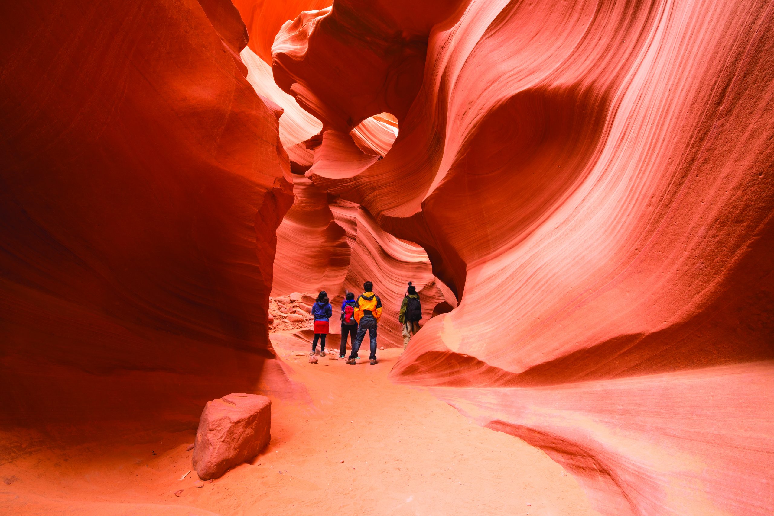 Antelope Canyon.
Bluff, population 250, is a small oasis nestled between two striking sandstone cliffs, carved eons ago by the San Juan River. The town has a rich history that combines the Mormon settlers who founded it in the 1880s, with Native American settlements established long before. Signs of Paleo-Indian cultures indicate a presence dating back to the end of the last Ice Age. The Ancient Puebloans — Anasazi — called this canyon country home from as early as A.D. 400, with an estimated 2,000 living in the area, their stories told in the numerous ruins and rock art that adorn rock panels and cliff pockets surrounding Bluff. In more recent times, the Bluff area was occupied by the Utes, Paiutes, and Navajo tribes, who recognized the San Juan River area as a fertile region for crop production. Today, Bluff is working on a comprehensive planning effort to help the town maintain its historic identity in the face of anticipated growth, as nearby communities, such as Moab, burst at the seams. The jumping off point for the recently created Bears Ears National Monument, Bluff also has good access to other beautiful and culturally fascinating areas.
Bluff Fort Historic Site (550 Black Locust Ave., 435.672.9995) features the buildings and tells the story of the Bluff Fort, situated along the Hole-in-the-Rock Trail. The fort was built between 1880 and 1882, under the direction of Mormons Erastus Snow, Brigham Young Jr., and church officials, who thought it best to build homes in a protected area in order to better protect themselves from local Indian tribes. Today, thanks to the Hole in the Rock Foundation, many of the cabins and buildings have been restored and rebuilt — 20 in all — and the story of why pioneers came to Bluff and the arduous journey it took to get there, is being retold.
For lunch in Bluff, we recommend Twin Rocks Café (on the Historic Loop in Bluff, 913 E. Navajo Twins Drive, 435.672.2341) a casual local favorite serving Navajo and vegetarian specialties and homemade soup.
Bears Ears National Monument (accessible from Bluff and Blanding) encompasses 201,876 acres of public land. This is among the most significant cultural landscapes in the United States, sacred to Native American tribes who rely on the lands in and around the monument for traditional and ceremonial uses. The monument is named for the Bears Ears Buttes, two prominent landforms that rise high above Cedar Mesa and resemble the ears of a bear poking its head above the horizon. Many area tribes have stories and legends in their oral traditions about the buttes. The monument is comprised of two units, the Shash Jáa Unit to the south and the Indian Creek Unit to north, both of which are famous for their abundant and outstanding rock art sites, pueblo dwellings, ceremonial sites, granaries, and many other cultural resources reflecting historical and cultural significance to diverse Native American peoples.
Valley of the Gods (10-mile roundtrip detour via Valley of the Gods Road) could be described as a smaller and more remote version of Monument Valley, with huge, isolated red sandstone rocks that tower over the valley floor. The valley lies at the base of Cedar Mesa, a 1,200-foot colorful bluff that forms a backdrop.
Monument Valley Navajo Tribal Park is one of the great natural wonders of the Navajo Nation. The Navajo call themselves Diné, The People, and The Navajo Nation is the largest tribe in the U.S. with almost 400,000 enrolled members. The reservation is the largest in the country, occupying land in northern Arizona, New Mexico, and Utah and covering 17.5-million acres, with landscapes varying from vast treeless washes and multicolored sandstone mesas and canyons to massive evergreen-covered mountains. Some canyons on the reservation reach 2,000 feet in depth, and the highest mountains are over 10,000 feet. Monument Valley Navajo Tribal Park, established in 1958, sits on the Arizona-Utah border and encompasses 30,000 acres. The surreal, cinematic landscape features towering buttes, jagged pinnacles, and shifting sand dunes. At an elevation of 5,500 feet, the high desert country receives an annual rainfall of only 8.5 inches. If Monument Valley looks familiar, you’ve probably seen it in one of many Hollywood westerns filmed there, including John Ford’s Stagecoach, filmed in 1938, and The Lone Ranger, filmed in 2013.
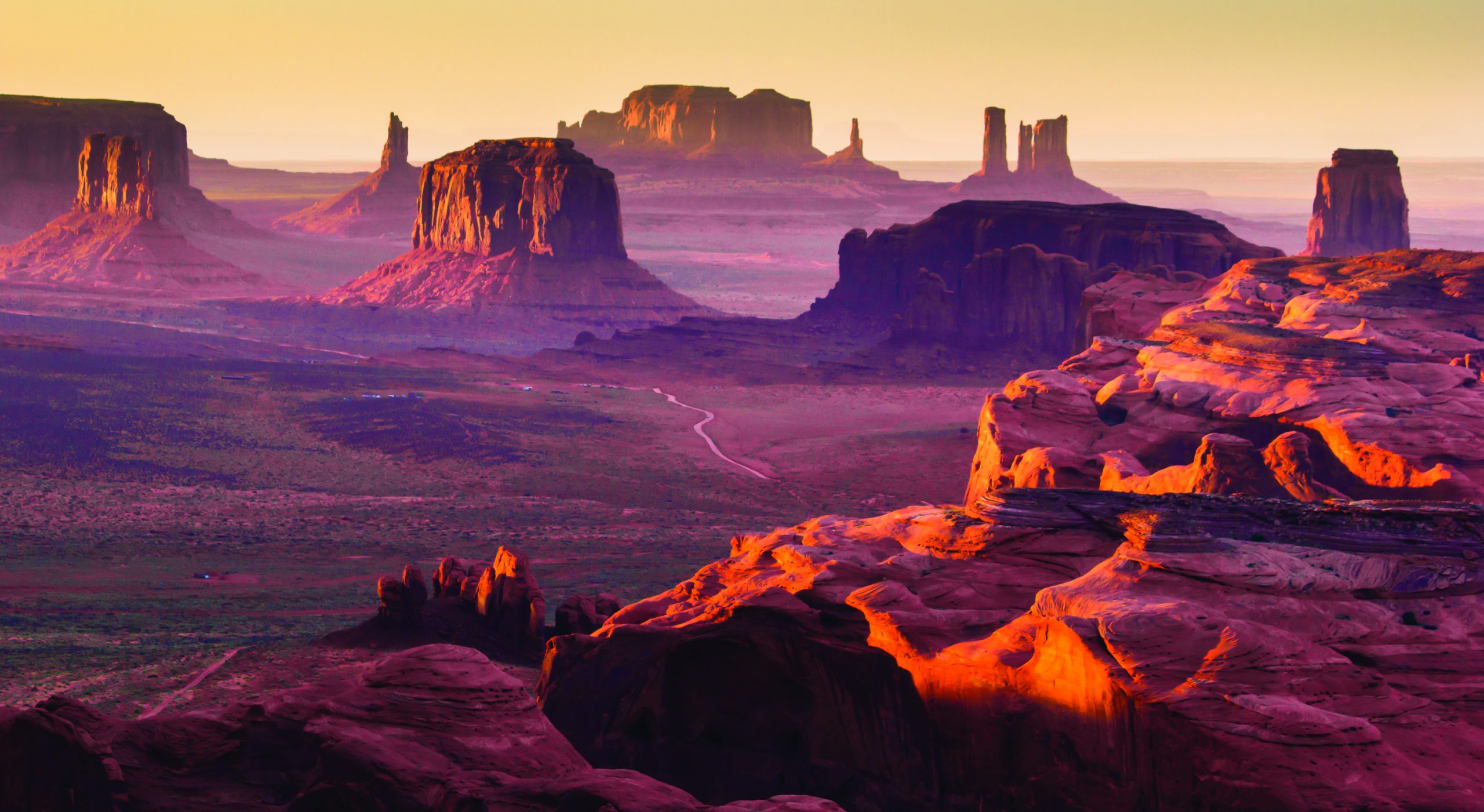 Monument Valley Tribal Park.
Monument Valley Scenic Drive (starts at the visitor center, located east on Monument Valley Road from Route 163) is a 17-mile, self-guided trip that loops through the heart of the valley, taking you past many of the most spectacular mesas, buttes, and spire rocks. Wildcat Trail (3.2-mile loop, self-guided, trailhead at The Mittens) takes you around West Mitten Butte and offers stunning views that you don’t have from the road.
For lunch in Monument Valley, we recommend the aptly named The View Restaurant (The View Hotel, Monument Valley Tribal Park, 435.727.5555), which serves an incomparable view and traditional Navajo and American food, prepared by a local chef.
Kayenta, the “Gateway to Monument Valley,” is located on the southern end of the Kayenta-Monument Valley Scenic Road, a 25-mile stretch along Route 163. The town sits in a bleak, windswept valley at 5,700 feet, and 5,200 people call it home. The name Kayenta is loosely derived from the Navajo name Teehindeeh, meaning “bog hole,” as there were once shallow lakes here.
Navajo Code Talkers Exhibit (Burger King, Route 160, Kayenta, 928.697.3534) is a panel that tells the story of the World War II code talkers. While other Indian languages had been used to deliver messages, it was determined that Navajo would work the best — it was particularly complex, an unwritten language, and only Navajo spoke it. With the goal of making it even more complex, the Marine Corps added some word substitutions. If you’re wondering why the exhibit is located in a Burger King, it’s because Richard Mike, the owner of three of the restaurants in the area, is the son of King Mike, a famous Navajo code talker. As Mike says, “We have here in Kayenta more code talker memorabilia than the Pentagon does.” Also in Kayenta you’ll find the Navajo Cultural Center (Route 163, 928.697.3170), which houses artifacts and has exhibits on Navajo history, traditions, and religious beliefs and includes videos of the Navajo code talkers. Open May through October.
Navajo National Monument (nine miles north of Route 160 on Route 564 to its end, 928.672.2700) was established in 1909 and preserves Betatakin, Keet Seel, and Inscription House, three spectacular prehistoric cliff dwellings last occupied about 700 years ago by the Kayenta Anasazi. The cliff dwellers flourished in this area for 50 years before mysteriously moving away for unknown reasons. Theories include drought, erosion, social pressures, religious dictates, or other influences that we know nothing about. Today, sheep and cattle ranching is critical to the Navajo way of life, and you’ll see livestock grazing in the area, just as you might have hundreds of years ago.
Betatakin Ruin sits at 7,200 feet in a high-vaulted alcove that opens onto a red-rock canyon of aspen, fir, and oak forests. The ruin holds 135 rooms in one kiva and is thought to have housed 75 to 100 people. Keet Seel is located in Tsegi Canyon, accessible by foot or horseback on a strenuous 17-mile roundtrip trail. It is one of the largest and best-preserved ruins in the Southwest, at one time housing as many as 150 people. Inscription House sits in a high, shallow sandstone alcove and was occupied from 1250 to 1300. Though the ruin is closed to the public due to its unstable, fragile condition, some tribal ceremonies are held there.
 House on Fire Ruin.
Guided Hikes to Betatakin Ruin (visitor center, 928.672.2700) are available year-round on a first-come, first-served basis. From Memorial Day through Labor Day, you can join an 8:15 a.m. Betatakin Tour along the Tsegi Point Trail (five miles roundtrip, 4–5 hours) or a 10 a.m. Betatakin Tour along the Aspen Trail (three miles roundtrip, 3 – 4 hours). From Labor Day to Memorial Day, you can join a 10 a.m. Betatakin Tour along the Sandal Trail. No reservations are taken, but your chances of getting onto a tour are excellent.
Tuba City (10 miles east of Route 89 on Route 160), sitting on the Navajo Reservation at the edge of the Hopi Reservation, is the largest community and the unofficial capital of western Navajoland. Most of the 8,600 residents of Tuba City are Navajo, though there is a small Hopi minority. You’ll find a number of Navajo tribal services in Tuba City, including a community center and the Indian hospital, and you’ll also find the Navajo Interactive Museum (Main and Moenave St., 623.412.0297), which offers great insight into Navajo life. The museum has four quadrants, each with an associated directional symbol, featuring land, language, history, and culture and ceremonial life. Just off of Route 160, 3.8 miles east of the junction of Routes 89 and 160 and seven miles southwest of Tuba City are some well-preserved dinosaur tracks and one of the most impressive dinosaur track sites in the country for their number and quality. Often there are Navajo jewelry stands set up where you can park, and Navajo guides who can take you on a short outing to the tracks.
Cameron Trading Post is one of the best trading posts in the area. Built in 1916 on the bank of the Little Colorado River, the trading post was named for Ralph Cameron, Arizona’s last delegate before statehood. The trading post is still actively used by the Navajos to sell and trade wool, livestock, and craft items for groceries and other household supplies. For lunch in Cameron, we highly recommend the Cameron Trading Post Restaurant (Route 89, 928.679.2231) where you can enjoy a delicious Indian taco. Choose from chicken, beef, and vegetarian in full or mini sizes. The spacious dining room, which is adorned with neat antiques and a tin ceiling, offers a great view of the Little Colorado River.
Tip: Along your route, stands hosted by Navajo people selling their craftwork present themselves. Do stop if you’re curious and would like to support their livelihood.
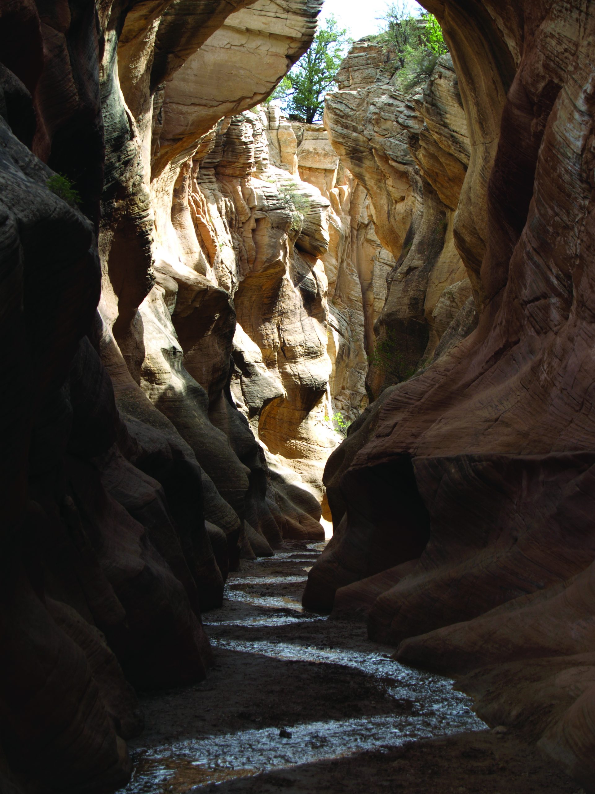 Willis Creek Slot Canyon.
Road Trip: Yellowstone Beartooth
Yellowstone Mammoth to Red Lodge, Montana
Your route takes you through some gorgeous areas of Yellowstone, predominantly the Lamar Valley, which sits in the northeast corner of the park and is known for its vast rolling terrain and abundant wildlife. The Beartooth Scenic Byway is a glorious 52 miles of road. You’ll want to time your day to include lots of stops to take it all in.
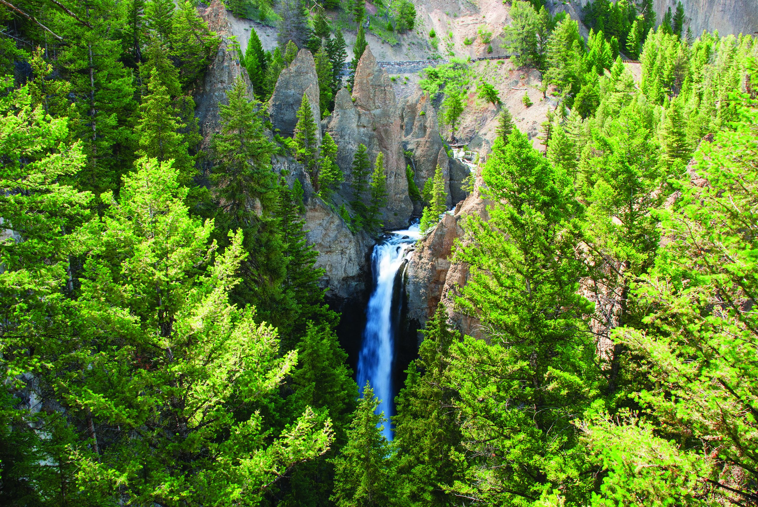 Tower Fall.
The Route
The drive from Mammoth Hot Springs to Red Lodge is 119 miles and will take approximately — all day! Okay, truthfully, it would take three hours without any stops or traffic. From Mammoth, take the park road east to Tower Junction. From Tower Junction, turn left and drive to the Northeast Entrance. Exit the park to Silver Gate, Montana, and you’ll be on Route 212, the Beartooth Scenic Byway. Take Route 212 over the Beartooth Pass and down to Red Lodge.
Discovery and Exploration
The Petrified Tree (between Mammoth and Tower Junction) is one of many petrified trees in this area of the park, though the only one that is easily accessible. Along this route you may also decide to take a short walk to Wraith Falls.
Tower Fall (three miles east of Tower Junction) is a lovely waterfall that was of particular interest in 1990 because a boulder, perched on the edge ever since Thomas Moran painted the waterfall in 1871, finally fell to the bottom. An interpretive sign used to point this out to attract attention to Tower Fall. Now Tower Fall is “just” another beautiful waterfall. Walk the long trail to the bottom of the fall and treat yourself to ice cream when you make it back to the top.
 Grizzly sow and cub.
Lamar Valley is primarily a wild, visual treat with wildlife as its most enticing feature. “The Lamar” has been an understated area of the park, visited in the past by people making their way to the Beartooth Scenic Byway. Since 1995, however, the valley has been quite famous with the reintroduction of wolves, which have maintained a wild and reliable presence in the valley. The Lamar Valley is now a top destination for wildlife lovers, and while it sees more visitors than ever before, you still might feel like you’ve got the place to yourself — it’s a big place. A broad mountain valley in the northeast corner of the park, it generally runs from east to west, with Montana’s Absaroka Mountains on its north side and Specimen Ridge forming the south side. It is the heart of what is called the park’s “northern range.” A short canyon, Lamar Canyon, runs for about two miles through the valley and contains some of the oldest rocks known in the park. The outcrops of schist and gneiss are more than 2 billion years old. The Lamar River runs through the valley and is fed by two tributary streams, Slough Creek and Soda Butte Creek. The Lamar Valley of Yellowstone Park is a primeval scene, now complete with wolves, as well as grizzly and black bears, coyotes, cougar, even wolverine, thousands of elk, pronghorn antelope, bighorn sheep, and perhaps 500 bison. In the course of an hour on an evening’s trip to a knoll in the Lamar Valley, it would not be unusual for wildlife observers to see elk, moose, mule deer, pronghorn antelope, bison, bighorn sheep, black bears, and grizzlies. The Lamar Valley may be the only place left on the face of the planet where this could happen.
Silver Gate is a tiny settlement at the border of Yellowstone National Park. It’s small, but somewhat charming.
Wildlife Along the Rockies (147 Highway 212 West, Silver Gate, 406.838.2296) is the gallery of Dan and Cindy Hartman, wildlife photographers who have captured incredible images of animals in their natural environment. Their photos have primarily been taken in their town of Silver Gate and inside Yellowstone National Park. You’re sure to enjoy browsing their gallery and hearing their tall (and true) tales of being out with their cameras in the wilds of Yellowstone. Look for the cozy log cabin tucked in among the lodgepole pines or the sign on the highway.
 Bison in Yellowstone.
Cooke City, relatively speaking a much larger town than Silver Gate, was established during the gold rush days as a mining town. Along with many other towns in the area, it was located in Indian territory, but that did not stop the pressing advancement of white settlers and subsequent progress of mining. The little settlement, which originally consisted of pine log structures with dirt roofs, was named after Jay Cooke Jr., son of the founder of the Northern Pacific Railroad. Chief Joseph of the Nez Perce tribe passed through here with his band of followers in 1877 on their fateful flight to Canada. In 1882, the government officially opened the country around Cooke City to settlement, beginning the first mining boom in the Beartooths. Today, this funky little town ebbs and flows with the change of seasons. During the summer, it bustles with activity as Yellowstone Park visitors stock up on supplies and souvenirs. In the fall and winter, the population shrinks considerably, with only a few stores, restaurants, and hotels remaining open to serve hunters, snowmobilers, and skiers. The fires of 1988 severely affected the country around Cooke City, and it was a miracle that the town was spared. You’ll see just how close the fires came. The town’s unique character was shaped by its stormy history and isolated location. To this day, Cooke City is inhabited by an interesting group of hardy individuals who make sure that the town’s distinct spirit lives on.
For lunch in Cooke City, we recommend The Beartooth Café (14 Main St., 406.838.2475) which ranks as Cooke City’s best, with soups, salads, sides, vegetarian items, burgers, and hot dogs. And there’s a great outdoor deck if the weather is right. MontAsia (102 E. Main St., 406.838.2382) was conceived by Lee and Yokie, who met in a kitchen at Montana State University. The menu features delicious beef, bison, and veggie burgers, and pasta, as well as pot stickers, egg rolls, kung pao, lo mein, and more! As they say, “Half Montana, Half Malaysia, All Good!”
The Beartooth Scenic Byway winds its way up this spectacular mountain pass, and when you finally reach the summit (there is a West Summit and an East Summit), you’ll feel as if you are on top of the world. The road climbs 4,000 feet from Red Lodge to the pass, and while the road begins and ends in Montana towns, Red Lodge and Cooke City, you’ll travel through quite a bit of Wyoming as you make your traverse. The state of Wyoming had the road designated a National Scenic Byway, part of a U.S. Department of Transportation program established to help recognize, preserve, and enhance selected roads throughout the United States. The awesome Beartooth Plateau landscape was formed by glaciers that swept over the area a few thousand years ago. There are many, many lakes throughout the plateau, and as you might imagine, the area is a hiker’s dream. Driving the 52 miles of pavement, you may take time to consider how difficult it must have been to build this road in the 1930s. First opened in June of 1936, the Beartooth Highway was the dream of a Red Lodge physician, J.C.F. Siegfriedt, who wanted to lure tourists and their dollars to the region after the Red Lodge economy collapsed due to the closing of the coal mines nearby. Five years in the making, the highway was a monumental undertaking that cost $2.5 million. Summer doesn’t arrive on the pass until mid-to late-July, and prior to that time you may encounter impressive snowbanks higher than your car. When summer does make its way to these elevations and the wildflowers pop out, you may just think you’ve arrived in heaven. For years and years, domestic sheep grazed on some of the hillsides along the pass, but in 2006 the sheepherders stopped grazing on this section of public land. But the wild version — bighorn sheep — and mountain goats are often spotted in the high mountain tundra.
 Beartooth Scenic Byway.
Red Lodge International Summer Ski and Snowboard Camp is located up the pass from Red Lodge. When it first opened in 1966 by two Austrian skiers to train Olympic hopefuls, the rear wheel of a jeep was used to power a rope tow. In 2002, two Red Lodge residents purchased the operating permit as well as two ski lifts, and the mountain is now open to the public for up to 100 skiers daily. But the skiing isn’t for just anyone — the pitch is steep and ranges from 15 to 50 degrees.
Picnic spots and leg-stretching along the pass can take place just about anywhere there is a pullout! Particularly nice ones are Island Lake and Beartooth Lake, both with trails and beautiful views. If we had to pick one, it would probably be Island Lake, where we recommend parking at the Island Lake Trailhead parking area and following the trail along the west side of Island Lake. The level trail skirts the lake, and depending on how far you choose to go, you can pass seven stunning bodies of water in one short hour. The trail will allow you to quickly feel immersed in the wildness of this beautiful high plateau country.
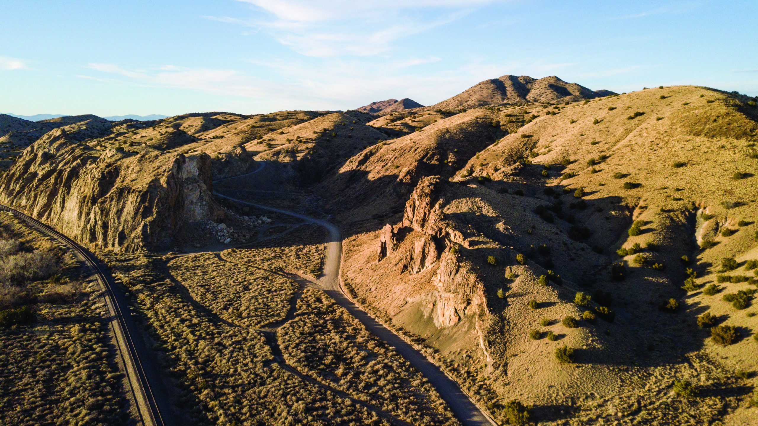
Road Trip: Turquoise Trail
Albuquerque to Santa Fe, New Mexico
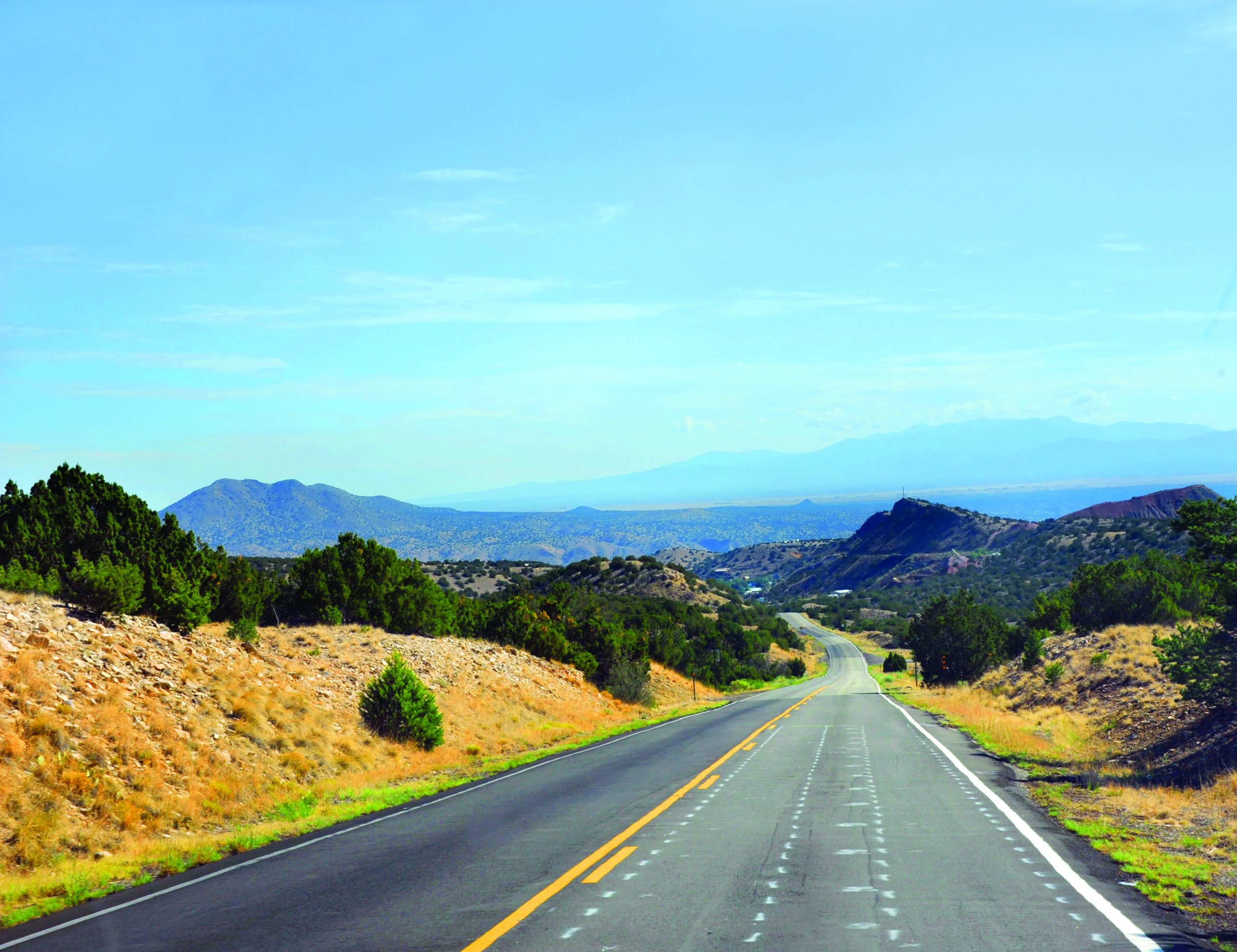
The turquoise trail is a beautiful alternative to Interstate 25 and is named for the highly prized turquoise that was mined in the Cerrillos Hills at the northern end of this scenic route. The road follows the “back side” of the Sandia Mountains then rolls through undulating cholla-rich hills and grassy plains, before straightening out for the last few miles into Santa Fe.
 The Turquoise Trail National Scenic Byway.
The Route
The drive from Albuquerque to Santa Fe via the Turquoise Trail is 75 miles and will take approximately 1.5 hours. From Albuquerque, make your way to Route 40 and drive east for 15 miles to Exit 175. Turn left onto Route 14, the Turquoise Trail, and follow it northeast for 46 miles to I-25 heading north. Follow I-25 north for five miles to Exit 282B for Route 285. Drive north on Route 285 into Santa Fe.
Discovery and Exploration
Turquoise was first discovered here more than 2,000 years ago, when the resident indigenous peoples of the Basket Maker culture mined the blue stone with primitive tools, fire, and water on the mountain they called Chalchihuitl. The mining continued on into the Pueblo Period, which began in about A.D. 500. When the Spanish invaded in the 1500s, they enslaved the Native population to excavate the blue stone. During a major excavation of Chalchihuitl, the entire west face of the mountain caved in and entombed the Indian laborers.
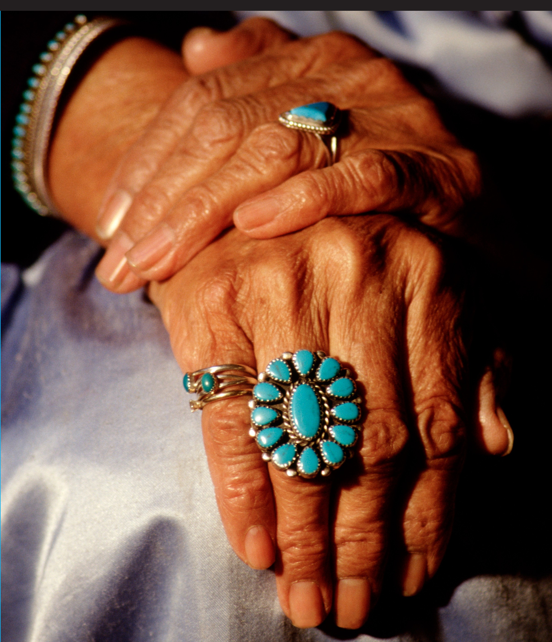 Turquoise jewelry.
The Turquoise Trail National Scenic Byway runs for 65 miles from Tijeras and the Cibola National Forest through Cedar Crest, Sandia Park, Edgewood, Golden, Madrid, and Cerrillos, ending in the San Marcos-Lone Butte area. Tijeras is home to approximately 200 families and the location of one of Cibola National Forest’s visitor centers. The national forest spans almost 2 million acres over three states.
Tijeras Pueblo Archaeological Site and Museum (11776 Highway 337, 0.6 miles south of Tijeras via Route 337 and 423, 505.281.3304) showcases information about the pre-European Ancestral Pueblo people who occupied the Tijeras Pueblo site. None of the structures still remain, but there is a self-guided trail with interpretive signs and renderings and a museum with exhibits on clothing, food, architecture, pottery, stone, tools, and archaeology, as well as a life-size reproduction of an excavated Pueblo room.
 Tijeras Pueblo Museum.
Tinkertown Museum (in Sandia Park, 505.281.5233) began in 1962 as a hobby of collector and constructor Ross Ward and grew into quite the museum. In a building fashioned from concrete and 55,000 bottles, you’ll find posters, antique signs, fortune-telling machines, and the main attraction — an array of 20,000 hand-carved miniatures all incorporated into dioramas depicting a variety of scenarios.
Golden, Madrid, and Cerillos are three former ghost towns that refused to stay dead. The towns recall the gold, copper, and silver rushes of a century ago, as well as renewed turquoise mining when the old Indian lodes were rediscovered. A desert landscape surrounds the towns’ false-fronted stores, pine-board sidewalks, adobe churches, and rusty mining equipment. Ghost town or not, there is much life in these towns today, with dozens of shops selling art, crafts, clothing, and antiques, as well as cafés, restaurants, and bars.
 Cerrillos Hills.
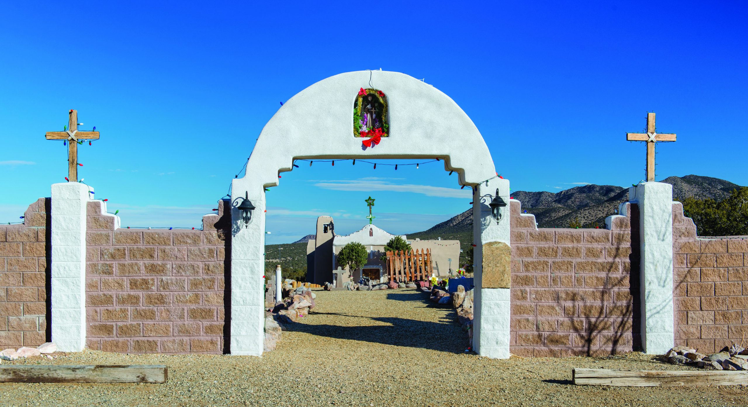
Golden was built in 1879 and opened its post office one year later. Henderson Store (1710 Route 14, Golden, 505.281.7136) has been family-owned since its beginnings in 1918, when Ernest and Lucy Riccon opened the Golden General Store. Today the Hendersons and their daughter and son-in-law sell high-quality Southwest Indian jewelry, rugs, and pottery. San Francisco de Asis Catholic Church (Golden, 505.471.1562) is a pretty, photogenic small church built in 1839 of local stone and mud mortar on a hilltop facing the San Pedro Mountains.
 San Francisco Church in Golden.
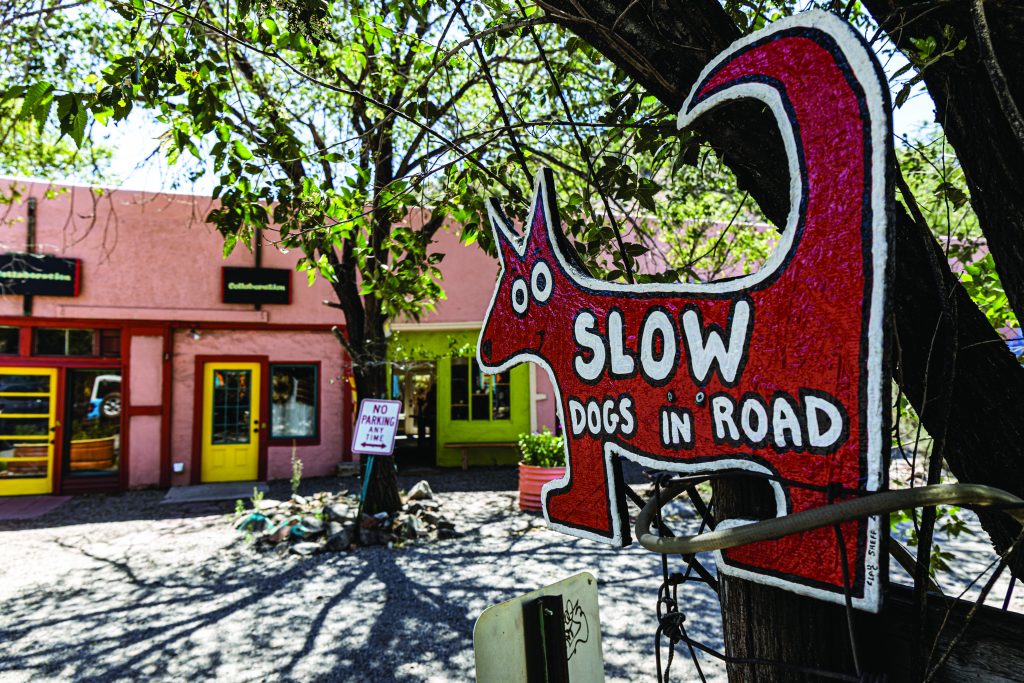
Madrid (say it like a local: MAD-rid) was a town settled and built by the Albuquerque & Cerrillos Coal Company in the 1800s. Black tailings piled up next to hillside mine shafts and a couple rows of two-story miner’s homes will be the indicator that you have arrived. In 1928, Madrid mines produced 87,148 tons of anthracite and 97,562 tons of bituminous coal. When the railroad companies switched to diesel shortly after WWII and natural gas replaced coal for other uses, Madrid’s mines and most of its homes and shops were abandoned. Shortly after the coal mine closed in the 1950s, owner Oscar Huber tried to sell the town for $250,000. There were no takers. Finally, in 1975, his son, Joe Huber, sold Madrid piece by piece. It took 16 days, and most of the 150 dilapidated buildings were sold for $1,500 to $7,000 each to artists and craftsmen who turned them into studios, boutiques, and gift shops. The 2007 Disney movie Wild Hogs was filmed in town.


Los Cerrillos is a sleepy hamlet hidden beneath cottonwoods. Rustic and unrefined is a good way to describe this town. Cerillos means “little hills,” and the town exudes the aura of a quiet Hispanic village. In contrast to Madrid, Los Cerillos looks back on a long history of Hispanic families who still live in the small enclave. The Turquoise Trail bypasses the town of about 200, which probably accounts for its ability to retain a sense of quiet. The collection of simple homes belies its heyday in the late 1800s when Ulysses S. Grant and Thomas Edison were guests at the Palace Hotel (it burned down in 1968). Edison came to Cerrillos with a plan to extract silver and gold from sand through electricity. It didn’t work. All that remains today are a few faded storefronts and dirt streets. Cerrillos has served as a movie set for over 12 motion pictures, most notably Young Guns in 1988. Casa Grande Trading Post and Cerrillos Turquoise Mining Museum (17 Waldo St., Cerrillos, 505.438.3008) are run by Todd and Patricia Brown, who make jewelry from Cerrillos turquoise and variscite from their two mining claims.
 Cerrillos.
Turquoise Trail Sculpture Garden and Studio (3453 Route 14 between mile markers 34 and 35, near Cerrillos, 505.471.4688) was created by artists Kevin and Jennifer Box and features a collection of sculptures on 35 acres that capture the texture, fragility, and impermanence of origami in outsized metal forms. There are cranes, boats, animals, and paper airplanes on display —as well as a rock-paper-scissors sculpture hanging above the visitor center. They are a “reduce, reuse, recycle” studio, and the majority of their casting process is done with recycled metal.
Pueblo San Marcos was one of the largest prehistoric adobe settlements in North America in the 15th and 16th centuries, consisting of an estimated 2,000 adobe rooms in 22 room blocks that some thought to be two- and three-stories high, enclosing 10 to 12 plazas, nine estimated midden areas, and 10 estimated kiva depressions. Today it is a significant archaeological site.
 Downtown Santa Fe handcrafted furniture and pottery
For lunch on the Turquoise Trail, we recommend the San Marcos Café and Feed Store (3877 Route 14, Seven miles north of Cerrillos, 505.471.9298) for great enchiladas and wonderful desserts in a cozy, cool atmosphere.
The State Penitentiary of New Mexico is marked with a barbed wire fence around a collection of severe-looking buildings. The penitentiary became known for one of the most violent prison riots in American history. Stemming from poor conditions, severe overcrowding, inmate mistreatment, and a “snitch” operation, the riots took place over the course of 36 hours in 1980.
Off the Beaten Path has been partnering for 30 years with travelers seeking adventure in the great outdoors and immersion into the local vibe and ethos. For more information about their trips, visit them at offthebeatenpath.com, or call 888.436.4285.
From the July 2025 issue.
PHOTOGRAPHY: Courtesy Off the Beaten Path; (header image) Courtesy Shutterstock; (Turquoise Trail images) Courtesy New Mexico True