The author of a new Indian Wars history gets lost in the past at the site of a crucial battle where Gen. George Crook lost his stomach for the fight some 140 years ago.
As a historian, I’ve always believed that walking the ground that I was writing about was essential to imparting an air of authenticity to the narrative. That was easy enough when it came to Civil War campaigns, which are the subject of five of my books, because most major Civil War battlefields are well-maintained national parks with easy access. When I decided to write The Earth Is Weeping: The Epic Story of the Indian Wars for the American West (Knopf, 2016), I knew that the task would be considerably more difficult because the area was so vast and the battlegrounds often remote, with many located on private ranches. Even those that are federally or state-maintained are for the most part off the beaten path. Although it meant putting many more miles on rental cars than I would have liked, I soon discovered this to be a godsend, as the relative isolation of Indian Wars sites has helped keep them in nearly pristine condition, enabling them to convey an immediacy and stir the imagination in a manner difficult to experience on Civil War battlegrounds that bristle with monuments and markers, swarm with visitors, and too often are located within a stone’s throw of distracting tourist traps or urban sprawl.
My field research for The Earth Is Weeping consequently proved more revealing — and exhilarating — than I had thought possible. A case in point is Rosebud Battlefield State Park in southeastern Montana. The park is less than 50 miles from Little Bighorn Battlefield National Monument, the most frequented Indian Wars site in the West, but it may as well be on another continent for all the traffic it gets. Little Bighorn played host to 317,000 visitors in 2015. The Rosebud, by contrast, had just 4,000 to 5,000 visitors. The imbalance is ironic. The Battle of the Rosebud was among the most important and confusing fights of the Indian Wars, with hundreds of widely dispersed warriors and soldiers charging and counterattacking for nearly six hours over multiple routes. There were nearly as many warriors at the Battle of the Rosebud, fought June 17, 1876, as there were at the Little Bighorn, and far more soldiers. More important, the blunting at the Rosebud of Gen. George Crook’s offensive contributed greatly to George Armstrong Custer’s annihilation a week later on the Little Bighorn.
On the bright, blistering morning of August 1, 2012, my stepson and I drove to Rosebud Battlefield State Park from our hotel “base of operations” in Sheridan, Wyoming. It was an easy ride along Montana Secondary Highway 314 for the first portion, while the last mile and a half consisted of a gravelly, unpaved lane.
I was prepared for the primitive state of the park. Huddled near the parking lot were an outhouse of sorts, a site map, a bronze National Historic Landmark plaque, and five large interpretive signs. The only other visible indications of civilization were several unobtrusive buildings belonging to the nearby historic Elmer E. “Slim” Kobold Ranch, and there was no one but us in the park. Private land abuts the park and extends as far as one can see in every direction, adding to the unspoiled splendor of the battlefield. There are just two descriptive markers in the rolling, starkly beautiful park — all 3,052 acres of which we intended to trek — and they’re so small as to be invisible until you’re nearly upon them (quite a contrast from the soaring monuments on many Civil War battlefields). We were, then, largely left to our own devices.
I had what I thought were the necessary tools to make sense of it all: a compass, a topographical map, the excellent, highly detailed series of maps of the battle in Charles D. Collins Jr.’s Atlas of the Sioux Wars (published by the Combat Studies Institute at Fort Leavenworth), a large hat, and plenty of water.

We set out for the Gap, a yawning dip in the prairie through which several hundred whooping and yelling warriors poured down upon the unsuspecting soldiers. With a weather eye for rattlesnakes, we trod through the knee-high wheatgrass toward a 5,000-year-old sandstone buffalo jump that marked the eastern edge of the Gap. Pausing frequently to absorb the awesome vastness of the place and imagine what had occurred there 136 years earlier, we delighted in the solitude. That is, until a tour bus lumbered into view on the unpaved road and then, to my amazement, swung up a long, low ridge known as Crook’s Hill a mile away, where it stopped to unload its passengers. Tourists. My heart sank. The spell was broken.
Once I got over my brief fit of pique, I realized that the bus might prove of benefit. Through no shortcoming in the Atlas, I was unable to determine if the low pine-studded rise at the end of Crook’s Hill was the important landmark known as the Conical Hill. I suggested to my stepson that we make our way over to Crook’s Hill — still keeping a lookout for snakes — to ask the tour group’s guide if he knew the answer.
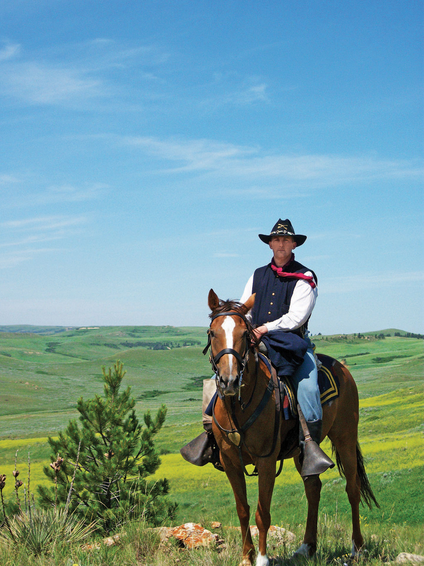
Cresting the hill, we came upon a most unexpected sight: a mounted horseman costumed as a cavalry officer and, beside him, a second rider uniformed in the buckskin dress of an army scout. Once over my surprise, I engaged them in conversation. They confirmed for me the location of the Conical Hill. The officer was Keith Herrin, proprietor of the U.S. Cavalry School, the mission of which is to “preserve the culture of the United States horse cavalry through education in cavalry history, horsemanship, tactics, and army life on the American frontier.” It is a mission, I subsequently learned, that the school fulfills in fine form, particularly through an annual eight-day immersion in cavalry life called “Custer’s Last Ride” on the Crow Agency adjacent to the Little Bighorn. The scout was Mark Brown, an expert in historic attire. What I had taken for tourists were in fact a group of Canadian military officers on a “staff ride” of the Rosebud.
After pointing out the Conical Hill, Keith kindly invited us to join the Canadian officers on another ride at the Little Bighorn the next day. We accepted with thanks and continued on our trek of the Rosebud battlefield, knowing that another adventure awaited us on the morrow.
Peter Cozzens is the author or editor of 16 books covering the Civil War and Indian Wars. His latest, The Earth Is Weeping: The Epic Story of the Indian Wars for the American West (Knopf, 2016), is available at bookstores and on Amazon.
From the January 2017 issue.


