Here are 10 lesser-known wonders of the Western world that are worth a summer trip.
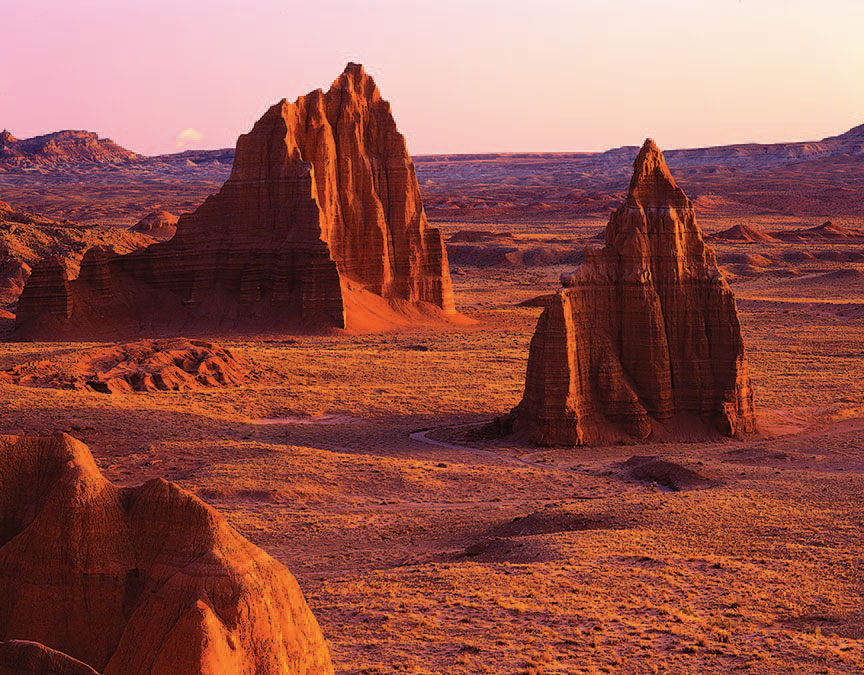
CAPITOL REEF NATIONAL PARK
Established: 1971 (1937 as a national monument)
Acreage: 241,904 Acres
Where: South-Central Utah
Annual Visitors: 663,670
Don’t be fooled by the nearly 700,000 official annual visitors to Utah’s most (unofficially) underappreciated national park. A good number of these guests are just commuting through its primary corridor, state Route 24, to more populated rock-star showcases out yonder, like Arches, Bryce, and, with 2.9 million visitors per year, Zion National Park.
“We are one of the least visited of Utah’s five national parks,” notes Capitol Reef’s visual information specialist, Christopher Roundtree. “Some of the visitors that pass through our park aren’t even aware of its existence, or at least its significance, until they get here.”
What’s the deal with the name? Early pioneers compared the park’s rounded Navajo Sandstone buttes to the roof of the U.S. Capitol, and old prospectors likened the park’s signature Waterpocket Fold, a dramatic, 100-mile long geological ridge, to a reeflike barrier.
Adding to the palette of colorful human history here is a former Butch Cassidy hide-out, 1,000-year-old petroglyph sites, and an old cattle trail road (the Burr Trail) that ranks among the most out-there desert drives in the West. But the showcase portrait is the painterly landscape itself, which approaches the unreal.
“Somebody looked at our aerial footage of Capitol Reef and said it was computer generated,” filmmaker Ken Burns once noted during an interview with The Salt Lake Tribune. “They can’t believe there is a place in the United States that looks like that.”
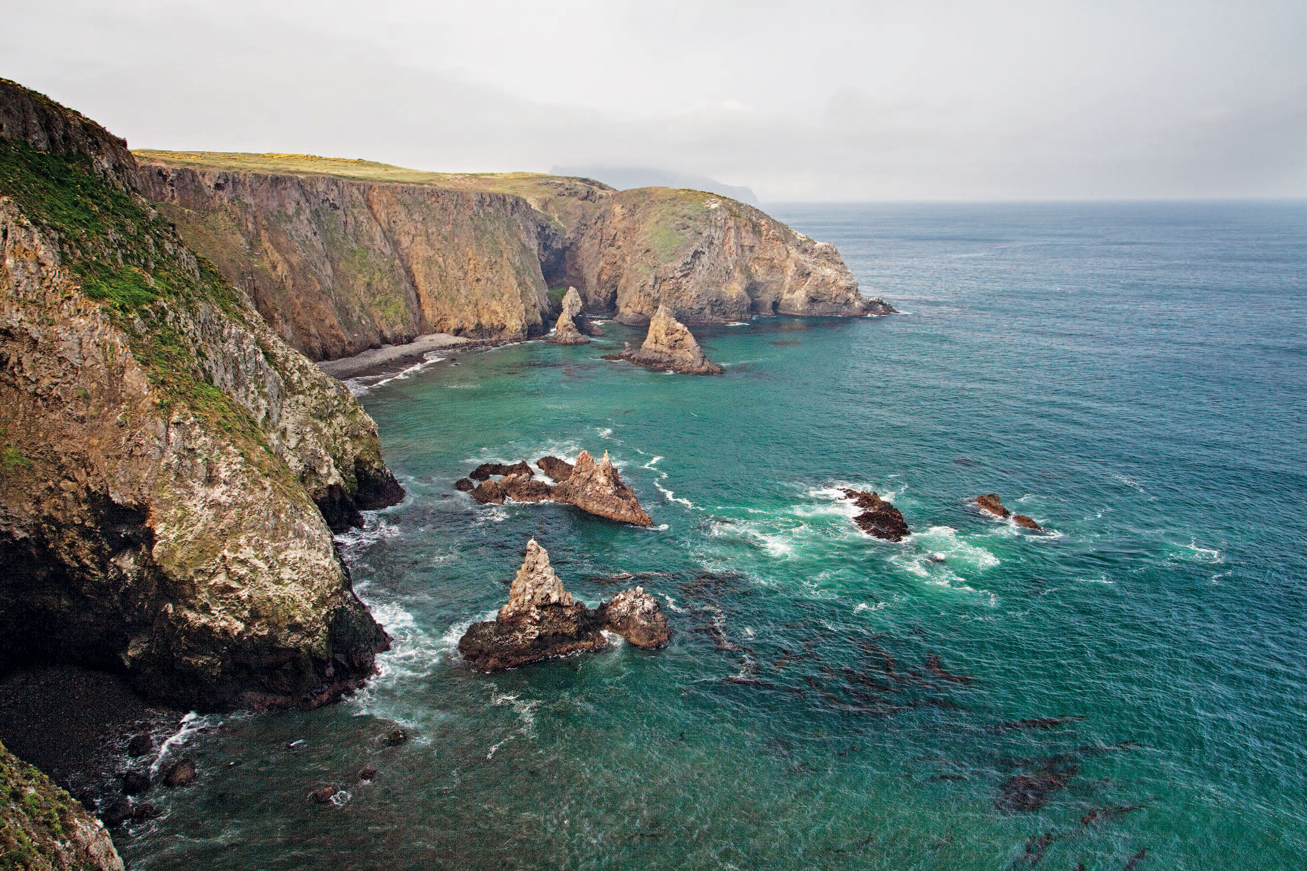
CHANNEL ISLANDS NATIONAL PARK
Established: 1980 (1938 as a national monument, for Anacapa and Santa Barbara islands)
Acreage: 125,000
Where: Off the Southern California Coast
Annual Visitors: 75,000
Floating off the California coast like an exclusive resort for pinnipeds, sea birds, and nearly 150 species of flora and animals found nowhere else on the planet, “North America’s Galápagos” comes by its nickname honestly.
Five islands — Anacapa, San Miguel, Santa Barbara, Santa Cruz, and Santa Rosa — make up this offshore preserve scattered across more than 1,200 square nautical miles. The archipelagic result of tectonic forces some 5 million years ago. Since then, the islands have hosted Chumash Indians, European explorers, Mexican prisoners, cattle ranchers, and — here’s where we come in — an alluringly small percentage of all those folks popping into the park’s mainland interpretive visitor centers in Ventura and Santa Barbara.
Boating out to the islands with a park concessionaire takes between 90 minutes to five hours (depending on which island) in seas that aren’t always exactly glassy. Greeting you on the other side is a highly protected ecosystem that remains as wild and untrammeled as the rest of Southern California isn’t.
Summer is the most popular season to visit these islands, but don’t overlook winter and spring — the best times to see migrating gray whales and some of the finest wildflower shows between LA and Tokyo.
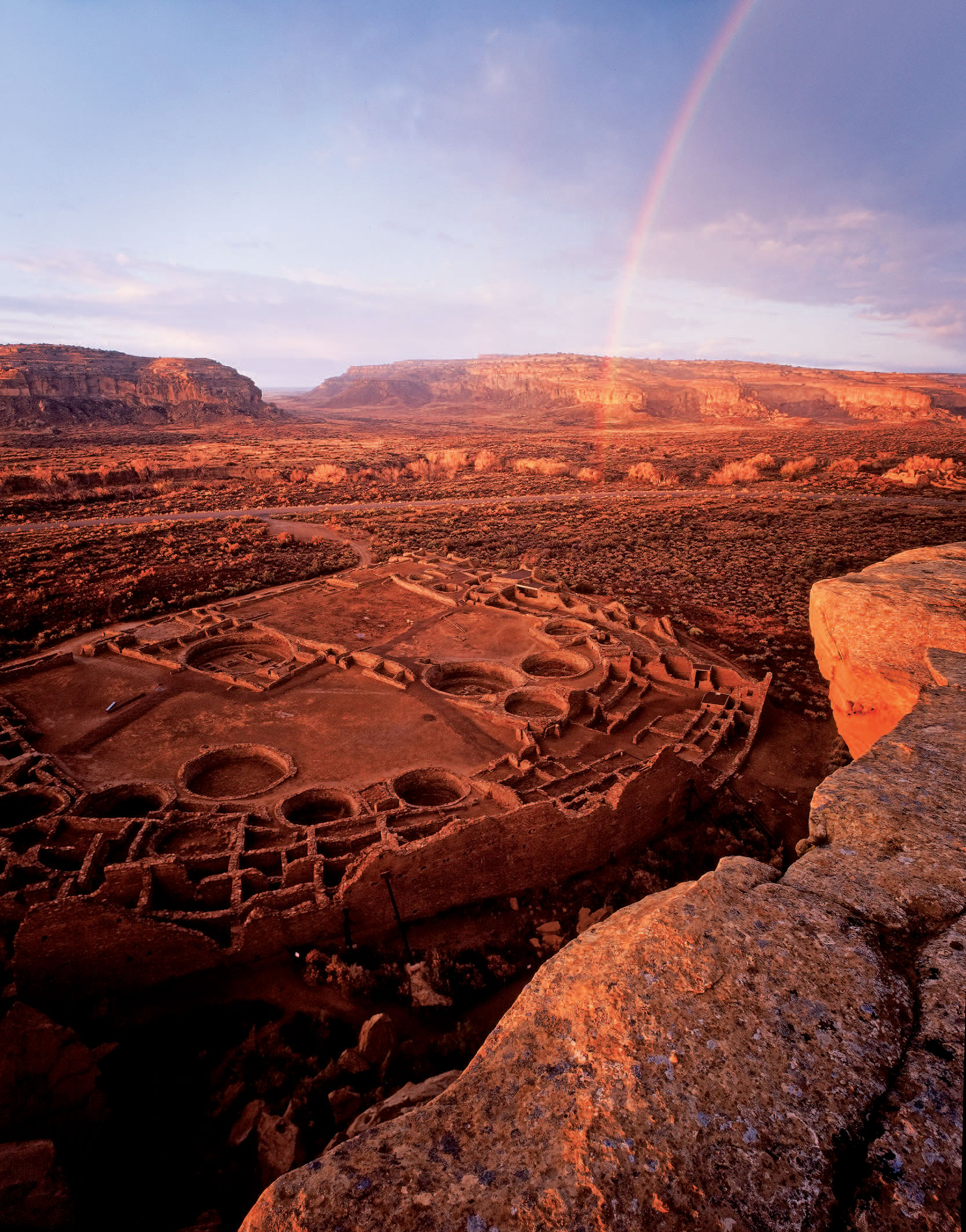
CHACO CULTURE NATIONAL HISTORICAL PARK
Established: 1980 (1907 as a national monument)
Acreage: 33,989
Where: Northwestern New Mexico
Annual Visitors: 29,917
“It’s not easy to get to, but it’s worth it.” That’s the usual refrain from tenacious visitors to Chaco Culture National Historical Park, home to some of the most spectacular pre-Columbian ruins ever overlooked by virtually everyone else.
More than a millennium ago, Chaco Canyon was an unlikely situated hub of Puebloan civilization — a desolate, desiccated expanse of high desert furnished with masterfully built “Great Houses,” giant kivas, and irrigation systems for a thriving culture. By the mid-13th century, this trade, administrative, and ceremonial center would be mysteriously abandoned, leaving future generations to quietly gawk at the remains of a lost world — now a UNESCO site — that hosted architectural endeavors rivaling ancient Rome’s.
Six of the park’s major Chacoan sites can be viewed (if not entirely grasped) along the park’s nine-mile Canyon Loop Drive. Venturing deeper into the park’s four backcountry trails leads to more remote Puebloan wonders outfitted with ancient petroglyphs, thousand-year-old stairs, and timeless vistas of a valley as silent now as it wasn’t a thousand years ago.
The caveat: Getting here involves extensive commutes along rough dirt roads in a corner of New Mexico that makes more popular, highway-friendly sites like Colorado’s Mesa Verde and Arizona’s Canyon de Chelly feel relatively convenient. The payoff: a parallel universe that can turn a front-wheel-drive vehicle (weather permitting) into a 15 mph time machine.
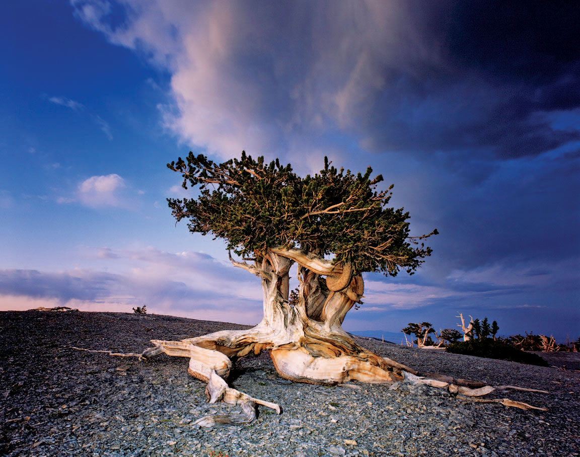
GREAT BASIN NATIONAL PARK
Established: 1986 (1922 as a national monument, for Lehman Caves)
Acreage: 77,180
Where: Eastern Nevada
Annual Visitors: 92,893
Standing in the vast solitude of Great Basin National Park, it may be hard to fathom that this remote preserve on the edge of Nevada (and, by extension, the universe) is just a small slice of something far bigger in these parts. But it is. The physiographic region the park is named after is a 200,000-square-mile ocean of undulating valleys and more than 150 mountain ranges stretching like petrified waves between the Rockies and the Sierra Nevada.
Silence and space: Those are the two greatest commodities in America’s Great Basin, it’s been said. But back to its namesake park — where, yes, those two qualities are as abundant as crisp, clean air. But so are several other less obvious treasures reserved for about .03 percent of National Park System visitors.
“People who make the long trip out here tend to find far more than the solitude, beautiful Lehman Caves, and dark night skies that we’re famous for,” notes Great Basin National Park’s chief of interpretation, Betsy Duncan-Clark. “The park’s tremendous range of ecosystems actually covers nearly 8,000 vertical feet — from sagebrush to subalpine — in less than 20 miles.”
Also gracing this greater basin is one of the continent’s southernmost glaciers, trout-filled creeks, the world’s longest living tree (an ancient bristlecone pine that is more than 4,900 years old), and 13,063-foot Wheeler Peak. Discriminating stargazers know the park as one of the darkest places in the lower 48 — and the quietest commute to a late summer Astronomy Festival along a route (U.S. Route 50) nicknamed “The Loneliest Road in America.”
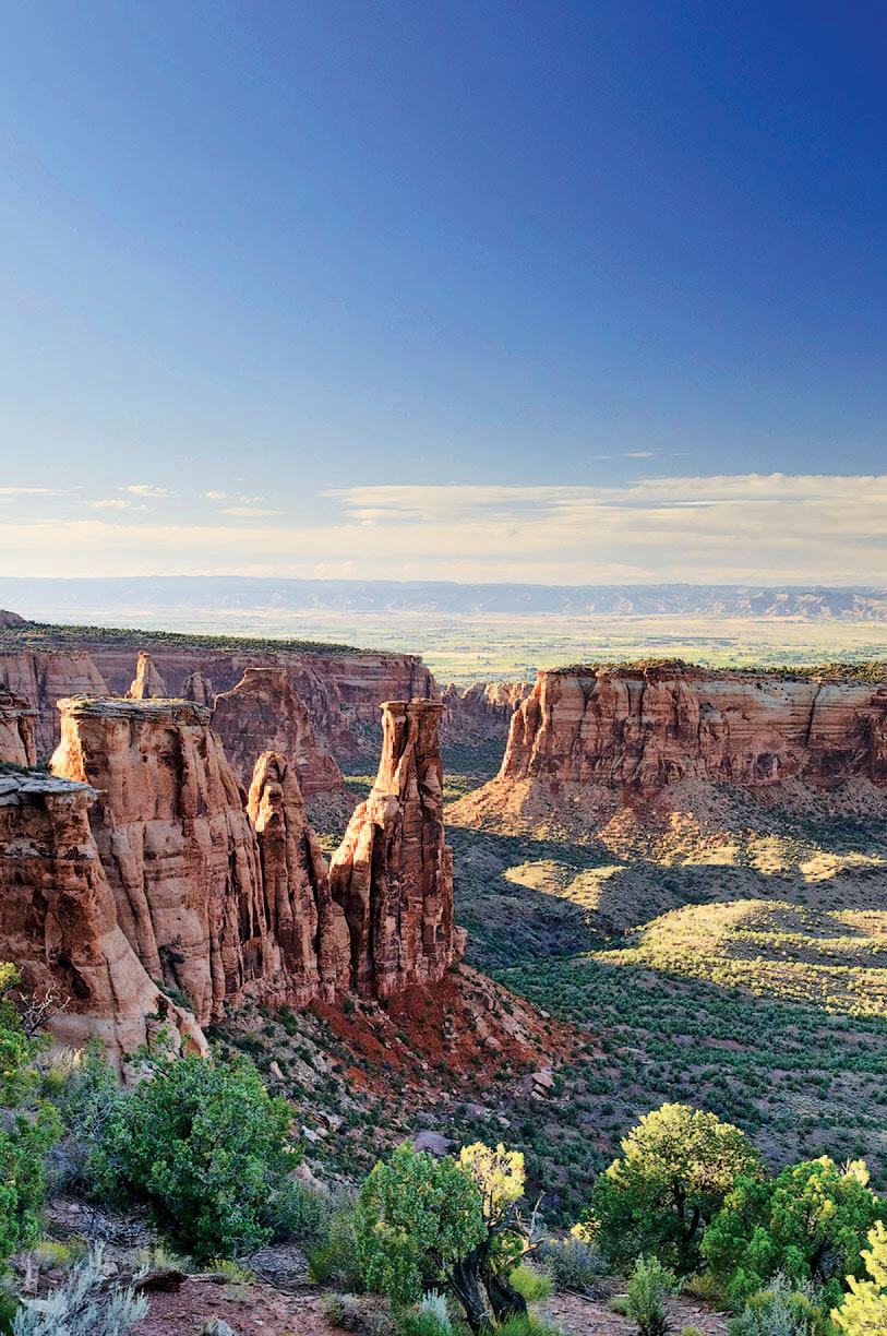
COLORADO NATIONAL MONUMENT
Established: 1911
Acreage: 20,500
Where: Western Colorado
Annual Visitors: 409,351
When you’re this pretty and just 7 miles from an interstate, folks are bound to notice you — at least while driving to bigger names like Arches and Canyonlands.
“A lot of people flying into Grand Junction [Colorado] or Denver are on their way to some of those better known parks in Utah and just happen to find us along the way,” says Karla Tanner, Colorado National Monument chief of interpretation and education.
The I-70 detour in this sensational red rock oasis is 23-mile Rim Rock Drive, a 1930s Civilian Conservation Corps project winding through sheer, juniper-studded canyons adorned with surreal natural sculptures like the park’s signature 450-foot Independence Monument. Yes, desert bighorn sheep and golden eagle sightings are common. Sure, you can still make it to Moab (about 100 miles away over the Utah border) before dusk. But staying awhile and hiking deeper into this chance discovery’s primordial backcountry on foot — or horseback on some trails — lasts a lifetime.
“When you’re out there it feels like you’re much farther away from civilization than you actually are,” adds Tanner. “And connected to what the area was like 100 years ago.”
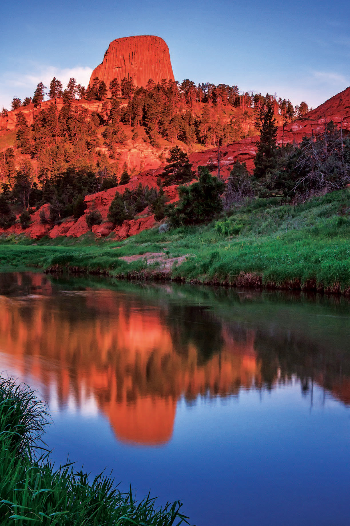
DEVILS TOWER NATIONAL MONUMENT
Established: 1906
Acreage: 1,347
Where: Northeastern Wyoming
Annual Visitors: 417,326
According to more than one Native legend, it’s the work of a stymied bear.
Those deep, folklore-inducing striations running down the 867-foot vertical face of Devils Tower. They happened when a bear gave chase to some young villagers, who huddled on a low rock and prayed to the Great Spirit to save them. As the rock rose skyward, the bear missed its mark and slid back from the summit with its claws out.
Whether you go with that theory or not, visitors to the country’s first national monument have described an elevated sense of well-being and serenity at this signature volcanic pillar — a rock-climbing Mecca, famous Close Encounters of the Third Kind set piece, way point for lone 19th-century horsemen, and sacred site to more than 20 Native tribes.
The tower (an “igneous intrusion” in geological terms) is a site to behold from any angle — and checklisters find them all here. An even wider-angle experience awaits wanderers along the compact park’s 8 miles of trails. Through piney meadows. Beside quiet riverbanks. In the shadow of a sacred, claw-marked monolith. Yeah, you’re out there — a safe 400 miles from those 3 million annual visitors gathering in Wyoming’s opposite upper corner at Yellowstone.
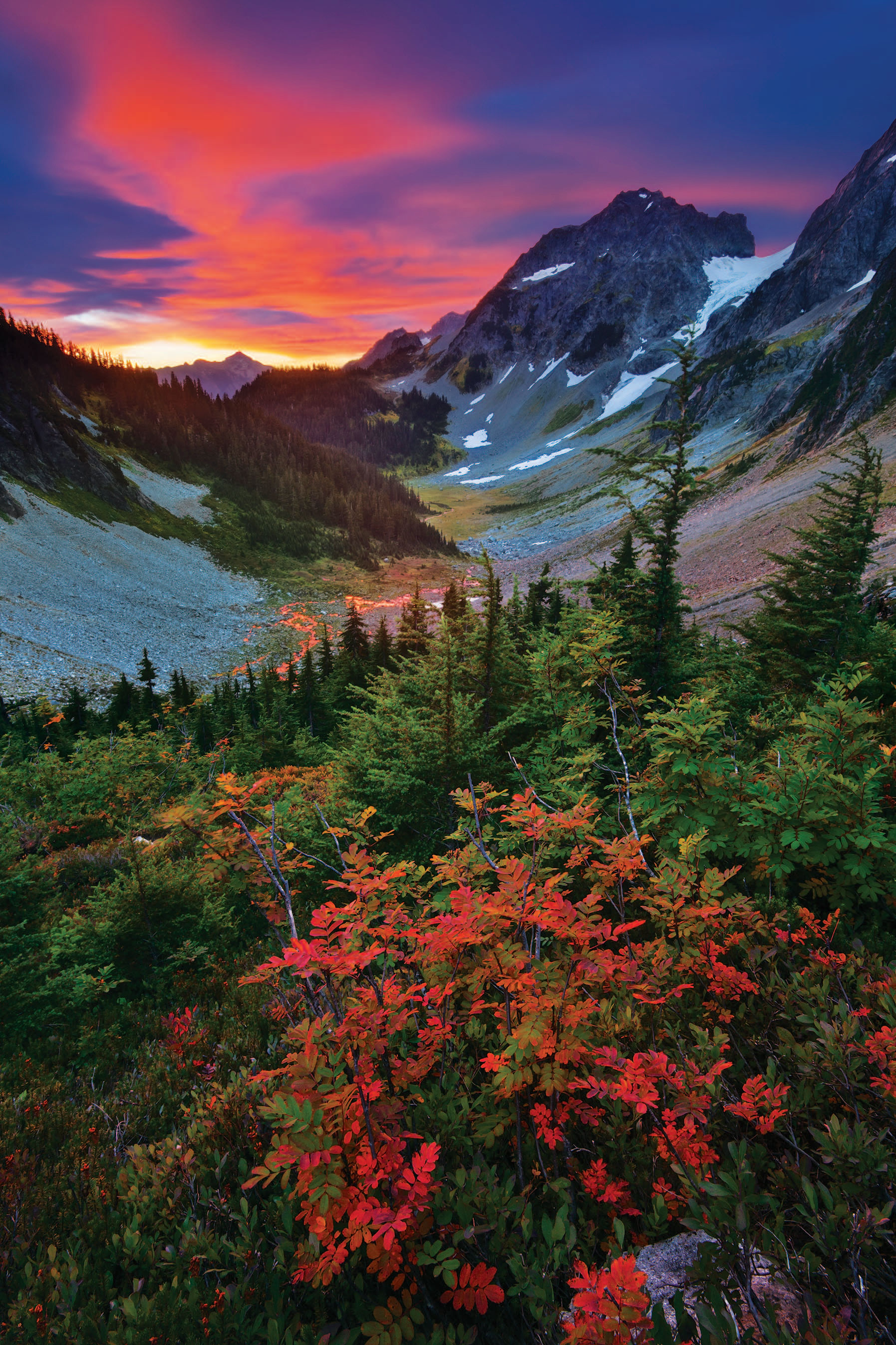
NORTH CASCADES NATIONAL PARK
Established: 1968
Acreage: 684,313
Where: Northern Washington
Annual Visitors: 21,623
Fun fact one: North Cascades National Park contains more than 300 glaciers in its snowy folds — more than half of the lower 48’s supply. Fun fact two: At its current visitation rates, it would take more than a century for this place (minus its two lakeside recreation areas adjoining it) to receive as many guests as, say, Glacier National Park gets in 12 months.
But while we have fun mulling over these factoids, you can bet the alpine wilderness fans escaping to North Cascades National Park are having even more of it in one of the most awe-inspiring alpine preserves to virtually never draw a crowd.
About 100 miles from Seattle but otherwise a whole mini-Alaska away, North Cascades was signed into law by Lyndon B. Johnson nearly 50 years ago to preserve a “certain majestic mountain scenery, snowfields, glaciers, alpine meadows, lakes and other unique glaciated features ... for the benefit, use and inspiration of present and future generations.”
Today, that list of majestic qualities remains pristine — and may look semi-impenetrable when driving along its gorgeous state Route 20 access route. But that’s all part of this place’s credo, which is nicely encapsulated in a recent management report: “Access to the park may not always be easy, but it is always worth the effort.”
Get out of the car and this spectacular, unpeopled backcountry serviced by hundreds of miles of hiking trails is all yours.
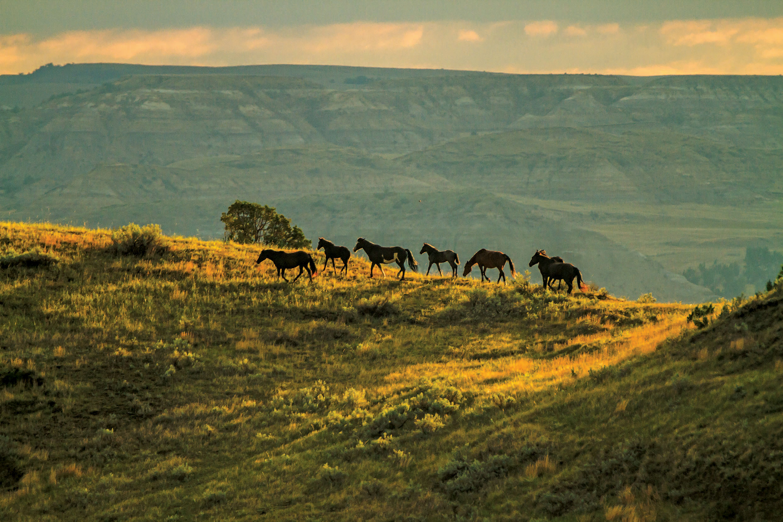
THEODORE ROOSEVELT NATIONAL PARK
Established: 1978 (1947 as a national memorial park)
Acreage: 70,446
Where: Western North Dakota
Annual Visitors: 545,090
“When people think of national parks, they usually don’t think of North Dakota,” says Eileen Andes, chief of interpretation at the state’s only one. “Many of our visitors find us while on the way to Yellowstone or Glacier. They see the big brown sign on the highway and pull over.”
Long before Theodore Roosevelt National Park became one of the best chance discoveries for nature lovers between Duluth, Minnesota, and Old Faithful, Teddy Roosevelt himself had lit out for this very territory in his 20s to hunt bison, try out cattle ranching, find solitude, and ultimately crystallize his lifelong passion for conservation.
The future president would describe this vast, haunting landscape of Great Northern Plains on the edge of the Dakota badlands as “a land of vast silent spaces, of lonely rivers, and of plains where the wild game stared at the passing horseman.” Today, it hasn’t changed much.
The park’s main South Unit, with its 36-mile scenic loop and horse-friendly trails, draws the bulk of its guests to Roosevelt’s preserved Maltese Cross Cabin and Painted Canyon for a quick sunset photo-op. Far fewer make it up to the park’s remote North Unit, where hikers are outnumbered by squeaking prairie dogs, roaming bison, and bighorn sheep.
The quietest section of all is Elkhorn Ranch, Roosevelt’s former ranch site, where the cabin is gone but the elements remain. “It’s quite an experiential thing listening to the very same river and rustling cottonwoods that Theodore Roosevelt wrote about,” says Andes. “People often have a very emotional reaction up there.”
NATCHEZ TRACE PARKWAY
Established: 1938
Distance: 444 miles
Where: Southwest Mississippi to middle Tennessee
Annual Visitors: 6,012,740
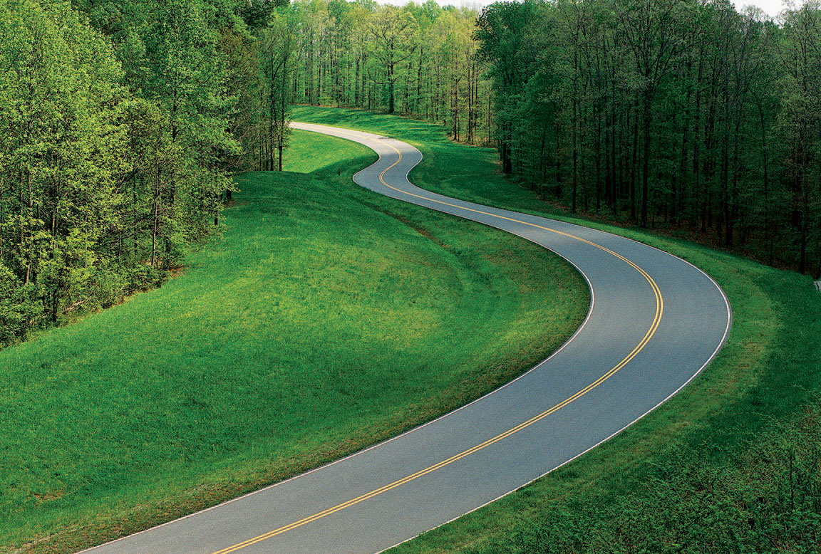
How does a road that receives more visitors than many of the busiest sites in the national park system make it onto a “lesser-visited” list? By being more than just a road, and showing no apparent signs of such traffic.
“We’re the eighth most visited national park in the country,” says Kristen Maxfield, one of Natchez Trace Parkway’s interpretive park rangers. “But you would never know it.”
No traffic lights or even stop signs. No Dunkin’ Donuts. No billboards or semis whizzing by. Rolling along the Natchez Trace Parkway at an unhurried 50 mph from Natchez, Mississippi, to Nashville — past three states, 444 mileposts, 7 degrees of latitude, and countless historical sites tucked between cotton fields, oak groves draped in Spanish moss, cypress swamps, three free campgrounds, miles of walking trails, and a friendly visitors center in Tupelo, Mississippi — is a different sort of driving experience. One that transports not just geographically, but temporally and spiritually.
Ten thousand years of North American history are commemorated along this parkway which parallels the original Natchez Trace — a former Indian trail that would become the early 19th-century lifeline connecting the frontier town of Nashville and the isolated district of Natchez in America’s “Old Southwest.”
Chickasaw and Choctaw Indians graced this route. So did U.S. Army generals (Ulysses S. Grant) and future presidents (Andrew Jackson). Artists (John James Audubon) and explorers (Meriwether Lewis). And outlaws who shall remain nameless.
And now so do we.
On a National Park Service road laced with enough history, heritage, and natural beauty to comfortably share with 6 million others and an entire nation. Where is everybody?
PALO DURO CANYON STATE PARK
Established: 1934
Acreage: 28,000
Where: Texas Panhandle
Annual Visitors: 303,000
Last year, more than 4.5 million people rolled through the gates of Grand Canyon National Park to gaze into the world’s most famous abyss. May we now direct your attention to another spectacular chasmic park down the road?
A state park about 700 miles east on Interstate 40 that comes by its nickname “The Grand Canyon of Texas” honestly enough — while reeling in less than 7 percent of the number of gawkers at that other one in Arizona.
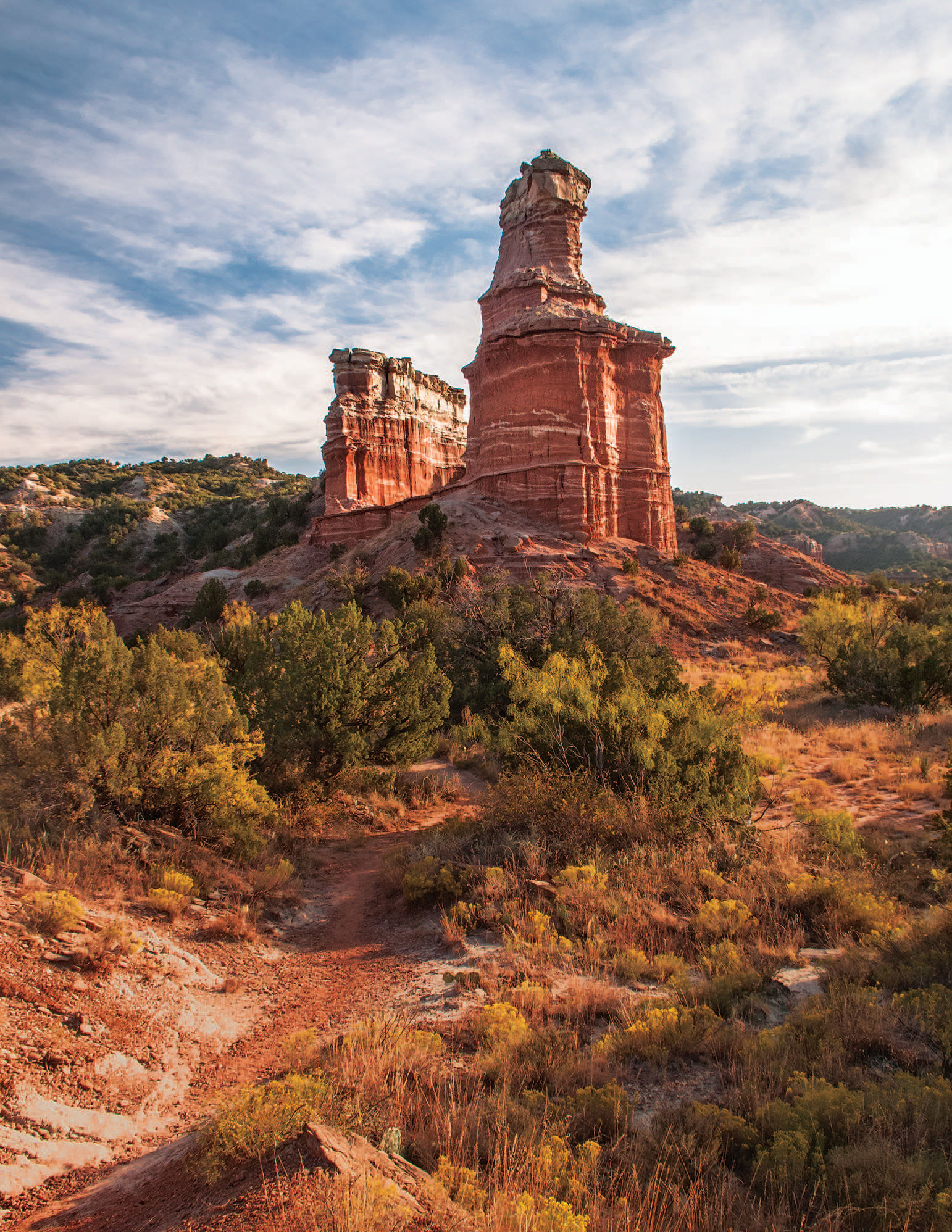
Easy enough to miss even from nearby Amarillo, Palo Duro Canyon is 120 miles long and 800 feet deep. A technicolor rockscape loaded with dramatic spires and pinnacles, blanketed with juniper, mesquite, and prickly pear — and conveniently furnished with an actual road winding through it.
“It’s the second largest canyon in the United States but we like to tell folks that it’s the largest canyon in the country that you can drive into,” says Palo Duro Canyon State Park superintendent Cory Evans. “Visitors love the fact that you can take the leisurely 16-mile round-trip drive into the canyon and see it from all angles.”
Guided horseback trips (departing from the park’s Old West Stables) bring visitors even more deeply in touch with a canyon that has logged an estimated 12,000 years of human history. Kiowa, Apache, and Comanche tribes took refuge here before succumbing to the Red River War. Legendary cattleman Charles Goodnight turned much of this canyon into part of his JA Ranch for a time. Later, Georgia O’Keeffe would traipse through here.
“A burning, seething cauldron, filled with dramatic light and color” is how the painter would affectionately describe Palo Duro Canyon.
Whoever finds their way here couldn’t agree more.
From the July 2014 issue.


