The Show Me State joined the Union on August 10, 1821. In a place defined by rivers, the best way to celebrate a bicentennial might just be from the water.
The dark clouds chased us. They gained on us, minute by minute, as we paddled down the Missouri River, following the slim serpentine channel in the wide river as best we could as we tried to outrun the storm behind us. As ominous as the clouds looked, the rain remained within them, their lightning and thunder bottled up. Until, finally, like an impatient driver laying on his horn behind a slow car, those dark clouds announced their presence with an angry clap.
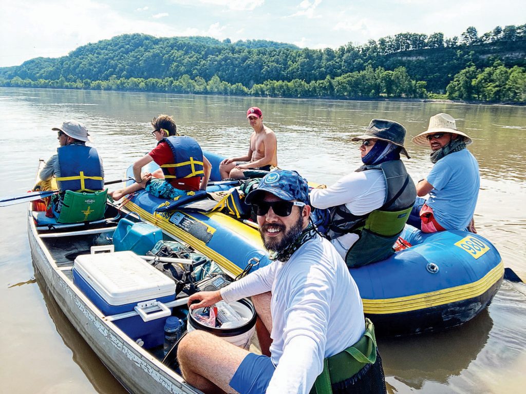
As the organizer of this three-day trip across Missouri, I felt responsible for the safety of our six-man crew. “Paddle to the shore, now,” I said to my five friends spread across a raft and a canoe that we had lashed together.
As I dug my paddle into the water, I glanced over my left shoulder to get a look at the storm. I wanted to know: How bad is it? In the foreground between me and the storm was my friend Micah. His straw hat shaded his intense eyes, and his face glowed red from the exertion of paddling on top of a base layer of sunburn from hours in Missouri’s baking heat.
My eyes jumped from Micah to the storm behind him. Now rain fell straight down, still far behind us but getting closer, ever closer. The rain looked like a charcoal sketch tinted green. The storm moved from left to right, across the river, as if God His-Very-Self was closing a shower curtain.
The rain didn’t worry me. It had been in the 90s all day on the river, and I almost welcomed the cool-down. What worried me was the lightning that came with that rain. Getting wet I looked forward to — getting electrocuted, not so much. We rammed our raft-canoe contraption ashore and stepped off the boats. My sandals found sharp rocks. My ankles twisted to show me how bad a choice my footwear was. More and bigger rocks along the embankment made a quick escape impossible. And even if we could have run on those rocks and up the embankment beyond them, we would have been running to tall lightning-rod trees.
I looked back again at the approaching storm and worried that our only two choices — stay on the banks of the river or hide in the forest — were both terrible.
We were trapped on rocks in a hard place.
I have lived in Missouri in two stints for a total of 13 years, all of it in the St. Louis area. I’ve never lived or been anywhere where so many people use the word we, as in “We’re a baseball town” or “We love Ted Drewes” (a frozen-custard institution) or “We have St. Louis-style pizza that tastes like cardboard with ketchup on it” (I might have altered that last one to reflect my own opinion).
Whether it’s the Cardinals’ (and to a lesser extent, the Kansas City Royals’) World Series championships, the 1904 World’s Fair, or the 1804 – 1806 Lewis and Clark expedition, the state is obsessed with its own history. For the bicentennial anniversary of Missouri becoming a state — it joined the Union on August 10, 1821 — I wanted to see as much of the Show Me State as possible, to absorb where that beloved history took place.
In the last few years, I have driven across it and up and down it. I have visited all four corners and the middle. I have camped in its forests and hiked on its trails and fished in its lakes and creeks. I have ridden my bike across it, three times. But the state’s history cannot be understood apart from its major rivers, the Mississippi and the Missouri.
The Mississippi River has long been the entrance to the West. Cross it, and right away you leave the East and enter the West. St. Louis’ location at the confluence of the two great rivers made it the origin point of the 1800s westward migration of settlers that would forever change the country — and Missouri.
It’s the Missouri River, though, that takes you deep into that West — or brings you home from it. To really understand Missouri, I felt like I had to experience it as it had been experienced in perhaps the most famous and most important event in its history: the Lewis and Clark expedition, the two-year-long trip to the Pacific Ocean and back, which still molds and shapes the state today, 217 years later.
My motley crew of river rats and our largely jury-rigged and slightly Quixotic expedition was of course not even a close facsimile of the epic Lewis and Clark endeavor. But it was a good way to spend a weekend with buddies and celebrate the state’s bicentennial. And I suppose my desire to see the river firsthand and the land from the water reflected that as a Missourian, I lived by the state’s “Show Me” nickname, a nod to the devotion of residents to that most beloved of writer’s rules: Show me, don’t tell me. An 1899 quote from Rep. Willard D. Vandiver sums it up: “Frothy eloquence neither convinces nor satisfies me. I’m from Missouri. You’ve got to show me.”
The Missouri is the longest river in all of North America. Unlike the historic westward movement it facilitated, it flows eastward and southward, originating in the Rockies of western Montana and joining up with the Mississippi around St. Louis.
To really understand Missouri, I felt like I had to experience it as it had been experienced in perhaps the most famous and most important event in its history: the Lewis and Clark expedition.
After the Lewis and Clark expedition, the portion of the Missouri River in Missouri became like a hub, with spokes heading all over the country. The California, Oregon, and Santa Fe trails all trace their starting points to the Missouri River. So, too, did the Pony Express, which took mail from St. Joseph, Missouri, to the West.
St. Charles and St. Louis grew as important stops from which travelers headed west. They had fresh water, stores to buy supplies, and access to the Missouri, Mississippi, and Illinois rivers, says Bill Brecht, education director of the Lewis & Clark Boat House and Museum, which overlooks the Missouri, in St. Charles. “If you’re going to travel great distances, or you’re looking to move farther west and you’re carrying all of your worldly goods with you, the river was the best way to travel,” Brecht says.
Lewis and Clark and their Corps of Discovery made winter camp and final preparations and launched from Camp River Dubois at the confluence of the Missouri and Mississippi rivers, and headed to St. Charles, 28 miles up the Missouri. Clark is known to have bought more tobacco for the trip in St. Charles, and after unloading and reloading to better distribute their loads — a sensible precaution our group had failed to take — they eventually continued up the Missouri, traveling it all the way to its headwaters in Montana, and eventually hooking up with the Columbia River for a final leg to the Pacific.
The river was their means to an end: to find a practical way to reach the Pacific while making friends with the Native Americans along the way. As Lewis and Clark traveled, the land they “discovered” was often occupied. They met roughly 50 Native American tribes, including the Yankton Sioux in South Dakota and Mandan in North Dakota. They negotiated peaceful agreements with most tribes — agreements to get tribes to make peace with each other and to trade with the U.S. rather than England, France, or Spain; arrangements to buy food, supplies, horses — all the while scouting the land for future development. “President Jefferson had instructed Lewis and Clark to report on the qualities of the area through which they traveled. How good is the land? How good is the soil? What kinds of mineral deposits, fauna, flora? What are the climates like?” Brecht says. “They were able to give reports on that. In future years, that became very important.”
Today river towns line the length of the Missouri River, from beginning to end. They have names you recognize — Bismarck, Omaha, and Kansas City — and others you don’t — Toston, Montana (population 73), Niobrara, Nebraska (294), and Pick City, North Dakota (136).
In case you were wondering (and this is straight from the website of the state’s secretary of state), Missouri gets its name from a tribe of Sioux Indians of the state called the Missouris. “The word ‘Missouri’ often has been construed to mean ‘muddy water’ but the Smithsonian Institution Bureau of American Ethnology has stated it means ‘town of the large canoes,’ and authorities have said the Indian syllables from which the word comes mean ‘wooden canoe people’ or ‘he of the big canoe.’”
Missouri gets its strength from its big cities: St. Louis, Kansas City, Springfield, Columbia. It gets its soul from its small ones, the little towns with big dreams along the Big Muddy. Communities such as Arrow Rock (population 36), Gasconade (334), and Lupus (25) rose and fell with the river trade and later railroads that ran parallel to the river. The sense of history is strong in most, if not all, of them. Indeed, the story of America’s westward expansion can’t be told without them.
You can hardly write about the state’s rivers and not mention the man who made them famous: Mark Twain. Unlike the Missouri, which he’s said to have commented was “too thick to drink, and too thin to plow,” Twain described the Mississippi in ways that made it seem glamorous and romantic. My earliest reading memory is of slowly devouring The Adventures of Tom Sawyer at my grandma’s house in suburban Detroit. In high school in the same area, I studied Huck Finn, strangely enough under an English teacher from Missouri. As I got older I reread Huck Finn again and again, and I naturally thought of him as the trip started. He would have raised hell on such a trip, and I assumed we would, too. Who wouldn’t want to spend lazy summer days on the water after reading about all the fun Tom Sawyer and Huck Finn had there?
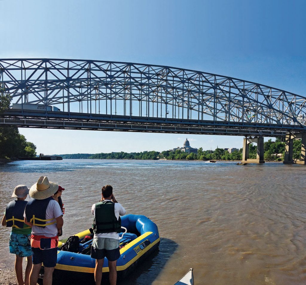
I gathered five adventure-minded friends and rented a raft and a canoe from Missouri River Excursions in Defiance, 37 miles from St. Louis. After a two-hour drive through wine country, we hit the river near the capitol building in the capital, Jefferson City, at mile marker 144 (the distance to the convergence with the Mississippi), roughly 116 miles from St. Charles, where Lewis and Clark began their journey in 1804. This is a Missouri-centric way of telling the story, but I’m a Missourian, and that’s how we roll. Even though several places lay claim to being the starting point for Lewis and Clark, St. Charles was definitely the last stop before the expedition set off.
I was nervous when I climbed aboard our four-person raft. I am not an experienced waterman, and the Missouri is an enormous river. In Corps of Discovery days, it was twice as wide and much shallower, Brecht says, but it was still more than 700 yards across at some points of our own journey of discovery and at least 400 for almost all of it. So, good reason to feel some trepidation as our corps put in. But my fears soon dissolved. Wide does not mean fast. An hour into the trip, as the state capitol faded into the distance, I discovered that to raft on the Missouri River was to float at an easy, languid pace, no more harrowing than the lazy river at your local waterpark.
The guys in the raft had no chance of keeping up with the guys in the canoe, and we soon stopped bothering to try. Instead, we tied the two vessels together. Most of the time we were content to let the river provide the power. That put our pace at 4 miles per hour, as long as we stayed in the channel.
We alternated between taking dips in the thick brown water to cool off and making fun of Micah’s 13-year-old son, Deacon, for not paddling enough. Whether he actually didn’t paddle enough was irrelevant: He’s young, and therefore he did not work hard enough. He took the ribbing with a smile. He offered no retort or rebuttal — Huck Finn he ain’t.
Lewis and Clark documented 178 previously unknown plants and 122 “new” animals in the two-plus years they explored this river in pursuit of a connection to the Pacific Ocean. In covering 88 miles across three days, we saw fish as big as our legs jump in the river, disturbed a deer at our first campsite, and shouted “’MERICA” every time we saw a bald eagle. All of which gave us a faint hint of what Lewis and Clark experienced.
But our moments of communing with nature were invariably interrupted by roaring trains or blinking cell towers or rumbling airplanes ... though I did at least appreciate the Cessna that dipped its wing to say hello to us from a few hundred feet above.
We spent many hours alone on the river, just us and the trees and ’MERICA! Golden rock faces rose high above the river. It was romantic to imagine that Lewis and Clark might have gazed on those same cliffs in similar light. They probably did, even if the river is narrower and deeper and follows a slightly different path now than it did then.
We joked often on the river about the differences between an adventure today and an adventure then. Lewis and Clark had several dozen men, a 55-foot keelboat, and pirogues and canoes. They ate as much as 9 pounds of meat each per day. We had a couple of coolers full of ice, enough junk food to put a bear into a sugar coma, and a guy using a cellphone to shoot a video application to be a contestant on the TV show Survivor.
Lewis and Clark calculated their speed by hand based on how far they went divided by how long it took them. We calculated our speed by turning on a cellphone, clicking on Google Maps, finding us as a dot in the river, then watching as our speed rose and fell based on how much or how little we paddled. Try as we might, we never quite reached double digits. I blamed Deacon.
I pondered the staggering thought that for all of human existence until Lewis and Clark left St. Charles in 1804, nobody had documented the whole Missouri River. Today, a mere 217 years later, sitting in the raft, covered in SPF 70, I held in my hand a device with which I could zoom in on high-resolution images of essentially every foot of the Missouri River’s 2,341 miles from its headwaters in Montana through seven states to where it dumps into the Mississippi River. (Side note: Typical naming conventions mean the portion of the Mississippi River after it meets the Missouri should be called the Missouri River because the Missouri River traveled longer to get there.)
But the trip was not without its moments of authenticity. We had to dodge that thunderstorm and in so doing faced the same challenges Lewis and Clark did in seeking shelter — namely, that there wasn’t any. We would just have to endure whatever hell nature unleashed on us. Lewis and Clark faced torrential rain, amounts of snow they had never seen before, and winds strong enough to nearly capsize the boat. “Back in the day, if you had bad weather, you dealt with it,” Brecht says. “They were braver about it than we are.”
I pondered the staggering thought that for all of human existence until Lewis and Clark left St. Charles in 1804, nobody had documented the whole Missouri River.
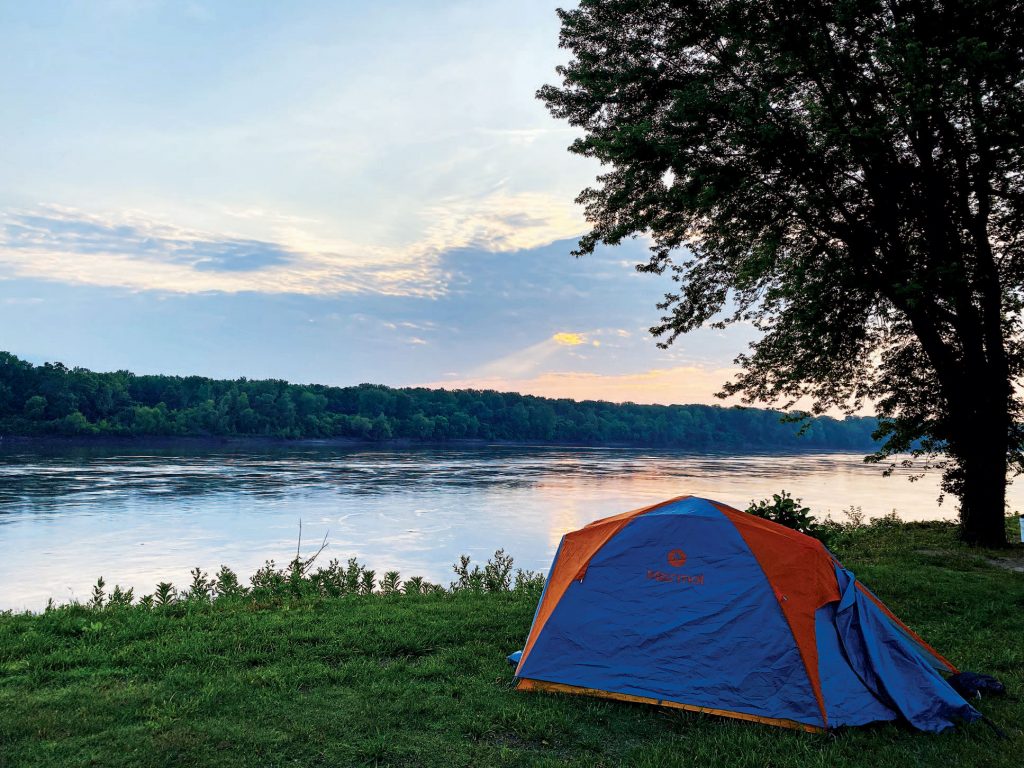
They were braver; we were luckier. The storm that threatened us kept going across the river instead of following it toward us. Relieved, we hit the water again, and a few hours later, we set up camp in New Haven (population 2,089). Founded as Miller’s Landing in 1836, New Haven sits on the south side of the river, about 80 miles from where the Missouri joins the Mississippi, deep in Missouri wine country.
From the minute we pulled our raft and canoe on shore, it was if someone lit the “Visitors are here!” signal in town that summoned the welcoming committee into action. It was a strange collection of Missourians, a group Twain could not have conjured on his best day.
A local glassblower regaled us with profane stories and redeemed that by giving Deacon an intricate globe. Dirty-Baby Guy borrowed wipes from us to clean up the infant son he had allowed to play on the river’s grungy banks.
Joggers, bikers, walkers, and people cruising in their cars all converged on the campground where we pitched our tents. They all wanted to say hello, to ask who we were and what we were doing, to simultaneously welcome us and bid us good luck on our journey.
I shouldn’t have been surprised by the warm welcome. As much as I like to make fun of Missourians for always saying we, the use of that word reflects a strong belief in community, a togetherness lacking elsewhere. If St. Louis is the Gateway to the West, the rest of Missouri is the West’s front porch, and guests are always invited to sit and talk.
Here we like a good porch visit. Apart from a float down a river, it just might be the best way to celebrate a 200th birthday.
Visit the Lewis & Clark Boat House and Museum online at lewisandclarkboathouse.org.
Photography: (All images) courtesy Matt Crossman
From our August/September 2021 issue


